Malaysia Federal Route 51
 | |
|---|---|
| Route information | |
| Length | 36.26 km (22.53 mi) |
| Major junctions | |
| West end | Seremban |
 FT 1 Federal Route 1 FT 1 Federal Route 1Seremban Inner Ring Road  FT 86 Federal Route 86 FT 86 Federal Route 86 FT 97 Jalan Senawang–Paroi FT 97 Jalan Senawang–Paroi Kajang–Seremban Highway Kajang–Seremban Highway FT 242 Persiaran Senawang 1 FT 242 Persiaran Senawang 1Jalan Lama Bukit Putus  FT 9 Federal Route 9 FT 9 Federal Route 9 | |
| East end | Kuala Pilah |
| Location | |
| Country | Malaysia |
| Primary destinations | Senawang, Paroi, Ulu Bendol, Seri Menanti, Tanjung Ipoh, Ampang Tinggi, Kuala Pilah |
| Highway system | |

Jalan Seremban-Kuala Pilah or Federal Route 51[1] is the main federal road in Negeri Sembilan, Malaysia, connecting Seremban to Kuala Pilah.[2] It is a relatively busy road in Negeri Sembilan.
Route background
The Kilometre Zero of the Federal Route 51 is located at Seremban, at its interchange with the Federal Route 1, the main trunk road of the central of Peninsular Malaysia. The road then meets up with Federal Route 97 at Ampangan and Paroi. The Federal Route 51 then meets E21 Kajang–Seremban Highway and FT242 Persiaran Senawang 1 as a multi-level stack interchange. The road then cuts through the Titiwangsa Mountains at Bukit Putus, acting as a mountain pass, where the road splits into 2 with Jalan Lama Bukit Putus taking the old section and FT51 taking the new section of the road until Ulu Bendul.
After both roads meet up at Ulu Bendul, the road passes through Ulu Bendul, a protected nature reserve and trail along with a village with the same name. The road then becomes the backbone for serving Seri Menanti at N29 Terachi and N24 Tanjung Ipoh, and Ampang Tinggi. At the end of the Federal Route 51, the road meets FT9 Karak–Tampin Highway at the downtown of Kuala Pilah.
History
The road was constructed by the British in the 1920s.
Features
The 48-metre tall Bukit Putus Viaduct is the fourth highest bridge in Malaysia, behind Jalan Bukit Kukus Paired Road in Penang, Rawang Bypass in Selangor and Lojing Viaduct in Kelantan.
At most sections, the Federal Route 51 was built under the JKR R5 road standard, with a speed limit of 90 km/h.
There is one alternate route: Bukit Putus Bypass (Jalan Lama Bukit Putus).
Bukit Putus section replacement bypass
The section of the Federal Route 51 from Paroi to Ulu Bendul known as Jalan Bukit Putus is notorious for its narrow and dangerous sharp corners. Construction of the new 6.7 km bypass including Bukit Putus Viaduct replacing the old narrow road started on 2006 and was completed in early 2009. In November 2009 the bypass was opened to traffic. The old route was re-gazetted as the Jalan Lama Bukit Putus.
Junction lists
The entire route is located in Negeri Sembilan.
| District | Location | km | Exit | Name | Destinations | Notes |
|---|---|---|---|---|---|---|
| Seremban | Seremban | 0.0 | Seremban | FT 1 Malaysia Federal Route 1 – Kajang, Mantin, Senawang, Rembau, Port Dickson   North–South Expressway Southern Route / AH2 – Kuala Lumpur, Johor Bahru North–South Expressway Southern Route / AH2 – Kuala Lumpur, Johor Bahru | Junctions | |
| | Rahang Besar | |||||
| Ampangan | | Ampangan-SIRR | Seremban Inner Ring Road – Mantin, Senawang, Port Dickson, Labu, Nilai North–South Expressway Southern Route / AH2 – Kuala Lumpur. Johor Bahru | Diamond interchange | ||
| | Jalan Jelebu | FT 86 Malaysia Federal Route 86 – Kuala Klawang (Jelebu), Pertang | T-junctions | |||
| | Ampangan | |||||
| Paroi | | Jalan Senawang–Paroi | FT 97 Jalan Senawang–Paroi – Senawang | T-junctions | ||
| | Paroi | Taman Paroi Jaya, Taman Pinggiran Golf, Paroi Sports Complex, Tuanku Abdul Rahman Stadium | ||||
| | Jalan Tok Dagang |  N101 Jalan Tok Dagang – Kuala Klawang N101 Jalan Tok Dagang – Kuala Klawang | T-junctions | |||
| | Jalan Senawang–Paroi and Kajang–Seremban Highway I/C | Kajang–Seremban Highway – Kajang, Mantin, Semenyih FT 242 Persiaran Senawang 1 – Senawang, Rembau North–South Expressway Southern Route / AH2 – Kuala Lumpur, Johor Bahru | Multi-level stack interchange | |||
| | FAMA Fruit Plaza | |||||
| Bukit Putus Viaduct | | Old roads ---m above sea level | Jalan Lama Bukit Putus (Old Roads) – Bukit Putus | T-junctions | ||
| 13.0 | ---m above sea level | |||||
| | Bukit Putus Viaduct ---m above sea level | |||||
| 14.0 | – | |||||
| | Bukit Putus Viaduct ---m above sea level | |||||
| 16.0 | 290m above sea level | |||||
| Seremban–Kuala Pilah district border | | 300m above sea level | ||||
| Kuala Pilah | Ulu Bendol | | Old roads 299m above sea level | Jalan Lama Bukit Putus (Old Roads) – Bukit Putus | T-junctions | |
| | Kuala Pilah welcome signs 298m above sea level | |||||
| | Ulu Bendol Rest and Service Area | |||||
| | Ulu Bendol Recreational Area | |||||
| | Sungai Batang Terachi bridge | |||||
| | Ulu Bendol Recreational Area | Ulu Bendol Recreational Area – Ulu Bendol Waterfalls, Ulu Bendol Snake Farm | T-junctions | |||
| | Teratak Ulu Bendol | |||||
| | Ulu Bendol Fishing Centre | |||||
| | Kampung Bendol | |||||
| | Kampung Ulu Bendol | |||||
| | Kampung Sawah Liat | |||||
| | Kampung Solok Paku | |||||
| | Kampung Gedang | |||||
| | Kampung Baharu Ulu Bendol | |||||
| | Kampung Kundangan | |||||
| | Kampung Pauh | |||||
| | Ayer Sejok | |||||
| Terachi | | Jalan Terachi–Seri Menanti | Jalan Ayer Hitam – Kampung Ayer HitamN29 Negeri Sembilan State Route N29 – Seri Menanti, Seri Menanti Old Palace, Tuanku Munawir Royal Mosque, Seri Menanti Royal Mausoleum | Junctions | ||
| | Terachi | Kampung Ibol | ||||
| Tanjung Ipoh | | Kampung Bukit | ||||
| | Tanjung Ipoh | N135 Jalan Lubuk Kadam – Lubuk Kadam, Talang Tengah | T-junctions | |||
| | Jalan Tanjung Ipoh–Senaling | N24 Negeri Sembilan State Route N24 – Senaling, Seri Menanti, Seri Menanti Old Palace, Tuanku Munawir Royal Mosque, Seri Menanti Royal Mausoleum | T-junctions | |||
| | Kampung Kuala Serdang | |||||
| | Sungai Seri Menanti Bridge | |||||
| Kuala Pilah | | Ampang Tinggi | N3 Jalan Ampang Tinggi – Kampung Kayu Ara, Kuala Pilah town centre, Bahau | T-junctions | ||
| | Kampung Gemelang | |||||
| | Kampung Gemuroh | |||||
| | Hospital Tuanku Najihah, Kuala Pilah | Hospital Tuanku Najihah, Kuala Pilah .jpg) | ||||
| | Kuala Pilah | FT 9 Malaysia Federal Route 9 – Karak, Batu Kikir, Bahau, Kuantan, Bentong, Johol, Tampin, Gemas, Segamat, Alor Gajah, Malacca City | Junctions | |||
| 1.000 mi = 1.609 km; 1.000 km = 0.621 mi | ||||||
Gallery
-
 FT51 in Ampangan, with the Negri Titiwangsa in the background
 -
 FT51 traverses through the Central Forest Spine's Titiwangsa Forest Complex near Bukit Putus on the Seremban–Kuala Pilah district boundary
 -
.jpg) Minangkabau-styled arched gateway on the intersection between FT51 and State Route N29 leading to Seri Menanti, near Terachi
Minangkabau-styled arched gateway on the intersection between FT51 and State Route N29 leading to Seri Menanti, near Terachi -
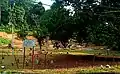 The Terachi section of FT51 is known for its megalithic sites
 -
 FT51 near Tanjung Ipoh
References
- ^ "Federal Roads (West Malaysia) (Amendment) (No. 12) Order 2011 [P.U. (A) 364/2011]" (PDF). Federal Government Gazette. Attorney General's Chambers of Malaysia. 2011-11-02.
- ^ "Statistik Jalan (Edisi 2013)". Statistik Jalan. Kuala Lumpur: Malaysian Public Works Department: 16–64. 2013. ISSN 1985-9619.