Monteleone d'Orvieto
Monteleone d'Orvieto | |
|---|---|
| Comune di Monteleone d'Orvieto | |
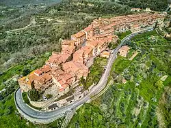 View of Monteleone d'Orvieto | |
 Coat of arms | |
  Monteleone d'Orvieto Location of Monteleone d'Orvieto in Italy 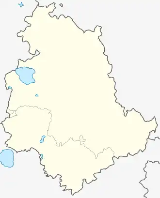 Monteleone d'Orvieto Monteleone d'Orvieto (Umbria) | |
| Coordinates: 42°54′59″N 12°03′05″E / 42.916446°N 12.051389°E | |
| Country | Italy |
| Region | Umbria |
| Province | Terni (TR) |
| Frazioni | Colle, San Lorenzo, Santa Maria, Spiazzolino |
| Government | |
| • Mayor | Angelo Larocca |
| Area | |
• Total | 23.9 km2 (9.2 sq mi) |
| Elevation | 500 m (1,600 ft) |
| Population (1 January 2025)[2] | |
• Total | 1,357 |
| • Density | 56.8/km2 (147/sq mi) |
| Demonym | Monteleonesi |
| Time zone | UTC+1 (CET) |
| • Summer (DST) | UTC+2 (CEST) |
| Postal code | 05017 |
| Dialing code | 0763 |
| Patron saint | St. Theodore, St. Paul and St. Peter |
| Saint day | June 29 |
| Website | Official website |
Monteleone d'Orvieto is a comune (municipality) in the Province of Terni in the Italian region Umbria, located about 35 km southwest of Perugia and about 60 km northwest of Terni. It is one of I Borghi più belli d'Italia ("The most beautiful villages of Italy").[3]
Etymology
Monteleone was so named by Pope Leo IX.[4]
History
The settlement was founded between 1050 and 1052 by Orvieto, which built a castle to guard its northern borders toward Chiusi, Perugia and Siena. From its origin it was equipped with strong defensive walls.[5]
During the 12th and 13th centuries it was held by the Monaldeschi and was involved in conflicts with the counts of Marsciano at Castel Brandetto and with the Bandini of Città della Pieve. In 1328 the castle was burned by the Filippeschi.[5]
In 1373 it was taken by force by the Viscount of Lorena, who believed the fief to belong to the territory of Chiusi. In 1374 he sold it to the noble Montemarte family, from whom he recovered it in 1377.[6]
Monteleone was later held by the Lorena and the Della Rovere. In 1498 Pope Alexander VI granted it to his son Cesare. Two years later, in 1500, it was seized by the Bandini.[5]
During the French invasion of 1798–1814 the town followed the course of events affecting other Umbrian localities.[5] A motu proprio issued on 6 July 1816 by Pope Pius VII classified it as a baronial place.[5]
In 1860 it was occupied by the Garibaldian captain Luigi Masi and annexed to the Kingdom of Italy.[5]
In 1895 Monteleone di Orvieto had about 2,000 inhabitants.[6]
Geography
Monteleone di Orvieto is a located about 7 kilometres (4.3 mi) from Città della Pieve, on an elevated hill at 495 metres (1,624 ft) above sea level. From this position it enjoys a wide view over the Valdichiana.[6]
Monteleone lies 8 miles (13 km) from Ficulle and 3 miles (4.8 km) from Montegabbione. The town is situated on elevated ground and was described as having a rather cold winter climate.[4]
The municipality includes the frazioni of Santa Maria, Colle Alto, Colle Basso and San Lorenzo.[5]
Religion
The principal church is the collegiate church of Saints Peter and Paul. In the apse there is an oil painting depicting the Pietà with two angels; below is represented the Virgin with gestures, and near the throne Saints Peter and Paul. The work is attributed to Perugino.[6]
Other churches include Madonna della Torre; the church of the Morte; the church of the Most Holy Annunciation; that of Saint Anthony of Padua, connected with the Mariottini palace; the church of the Most Holy Crucifix, located a short distance to the north of the town; and Saint Roch and Saint Angelo, both outside the town.[4]
The church of Saint Angelo stands in the villa of the same name about 1.5 miles (2.4 km) to the southeast. Other churches include that of Colle San Cristoforo to the south, built by the Cecchetti family; Santa Maria Maddalena to the south in the villa of Santa Maria; San Biagio about 0.25 miles (0.40 km) to the southwest; and a church of Saint Anthony, then abandoned, 2 miles (3.2 km) away near the boundary of Montegabbione.[4]
The feast of the patron saint, Saint Theodore, is celebrated on the fourth Sunday of May.[4]
Main sights
- Remains of the medieval walls, including the northern gate.
- Church of SS. Apostoli Pietro e Paolo. It houses a Madonna with Child between Sts. Paul and Peter, once attributed to Perugino but most likely from his collaborator Giacomo di Ser Guglielmo of Città della Pieve.
- Church of SS. Crocifisso (17th century)
- Medieval Torrione ("Big Tower"), offering a wide panorama of Umbria, Tuscany and Lazio.
- Castel Brandetto (11th century, destroyed in 1350). Now it is a private-owned residence showing few remains of the medieval edifice.
Notable families
The town is recorded as the birthplace of Consiglio Dardalini, a noted mosaicist and head of the craftsmen responsible for the façade of Orvieto Cathedral.[4]
Among the principal families recorded in the 19th century were the Lemmi, Marocchi, and Brizi.[4]
References
- ^ "Superficie di Comuni Province e Regioni italiane al 9 ottobre 2011". Italian National Institute of Statistics. Retrieved 16 March 2019.
- ^ "Resident population by age, sex and marital status on 1st January 2025". Istat. Retrieved 15 February 2026.
- ^ "Umbria" (in Italian). Retrieved 1 August 2023.
- ^ a b c d e f g Palmieri, Adone (1858). Topografia statistica dello Stato Pontificio. Vol. 4. Tipografia Forense. p. 162-163.
- ^ a b c d e f g "Comune di Monteleone d'Orvieto". Sistema Informativo Unificato per le Soprintendenze Archivistiche (in Italian). Retrieved 14 February 2026.
- ^ a b c d Strafforello, Gustavo (1895). La patria; geografia dell'Italia. Provincia di Perugia. Unione Tipografico-Editrice. p. 184.