Avigliano Umbro
Avigliano Umbro | |
|---|---|
| Comune di Avigliano Umbro | |
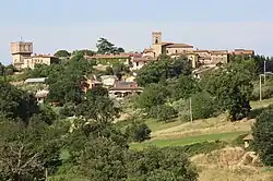 View of Avigliano Umbro | |
 Coat of arms | |
.svg.png) Avigliano Umbro within the Province of Terni | |
  Avigliano Umbro Location of Avigliano Umbro in Italy 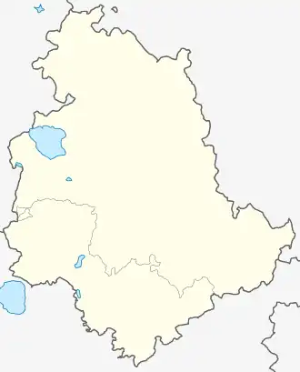 Avigliano Umbro Avigliano Umbro (Umbria) | |
| Coordinates: 42°39′16.92″N 12°25′42.53″E / 42.6547000°N 12.4284806°E | |
| Country | Italy |
| Region | Umbria |
| Province | Terni (TR) |
| Frazioni | Dunarobba, Santa Restituta, Sismano, Toscolano |
| Government | |
| • Mayor | Luciano Conti |
| Area | |
• Total | 51.32 km2 (19.81 sq mi) |
| Elevation | 441 m (1,447 ft) |
| Population (1 January 2025)[2] | |
• Total | 2,317 |
| • Density | 45.15/km2 (116.9/sq mi) |
| Demonym | Aviglianesi |
| Time zone | UTC+1 (CET) |
| • Summer (DST) | UTC+2 (CEST) |
| Postal code | 05020 |
| Dialing code | 0744 |
| Website | Official website |
Avigliano Umbro is a comune (municipality) in the Province of Terni in the Italian region Umbria, located about 50 km south of Perugia and about 20 km northwest of Terni. As of the 2021 census its population was of 2,317.[2]
History
The territory of Avigliano has been inhabited since prehistoric times, as attested by archaeological discoveries at the Grotta Bella of Santa Restituta.[3]
During the Roman era, the settlement was located along the Via Amerina. In the Middle Ages, Avigliano emerged as an important center within the territory known as the Terre Arnolfe. It is mentioned in the regesto of Farfa Abbey. In the 12th century, following the dissolution of the Arnolfi lordship, the territory passed under the dominion of Todi.[3]
In 1859, Avigliano had a population of 610 inhabitants, living in 112 families occupying 112 houses. In the mid-19th century, the inhabitants of Avigliano were described as almost entirely landowning agriculturalists.[4]
In 1975 Avigliano Umbro became an independent municipality after separating from Montecastrilli.[5]
Geography
Avigliano is situated on a high hill and lies about 4.5 miles (7.2 km) from Montecastrilli, 8 miles (13 km) from Amelia, and approximately 12 miles (19 km) from both Todi and Narni.[4]
Its associated hamlets include Dunarobba, Santa Restituta, and Toscolano. Santa Restituta and Toscolano are each about 6 miles (9.7 km) distant. These settlements are generally situated on hills near the Monti Corsini. The area is characterized by woodland, and chestnut trees are particularly abundant.[4]
The municipality borders with Acquasparta, Amelia Guardea, Montecastrilli, Montecchio, and Todi, this one in the Province of Perugia.[6]
Religion and culture
Avigliano has the churches of Sant'Angelo, San Giovanni, Sant'Egidio, and the church of the Santissima Trinità.[4]
The parish church of the Santissima Trinità, built in the first half of the 17th century, contains notable frescoes attributed to Bartolomeo Barbiani and a painting by Polinori depicting the Madonna of the Rosary with Child, Saints, and Mysteries.[3]
The town also has a characteristic Liberty-style theatre, built in 1928.[3]
References
- ^ (in Italian) Avigliano Umbro on comuni-italiani.it
- ^ a b "Resident population by age, sex and marital status on 1st January 2025". Istat. Retrieved 15 February 2026.
- ^ a b c d "Il territorio di Avigliano Umbro". Proloco Avigliano Umbro (in Italian). Retrieved 16 February 2026.
- ^ a b c d Palmieri, Adone (1859). Topografia statistica dello Stato Pontificio. Vol. 5. Tipografia Forense. p. 86-88.
- ^ "Comune di Avigliano Umbro". Sistema Informativo Unificato per le Soprintendenze Archivistiche (in Italian). Retrieved 14 February 2026.
- ^ 42112 Avigliano Umbro on OpenStreetMap
External links

- Official website (in Italian)
- Pro Loco Avigliano Umbro (Office of Tourism) (in Italian)