2025–26 Australian region cyclone season
| 2025–26 Australian region cyclone season | |
|---|---|
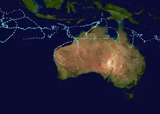 Season summary map | |
| Seasonal boundaries | |
| First system formed | 15 July 2025 |
| Last system dissipated | Season ongoing |
| Strongest storm | |
| Name | Fina |
| • Maximum winds | 195 km/h (120 mph) (10-minute sustained) |
| • Lowest pressure | 938 hPa (mbar) |
| Seasonal statistics | |
| Tropical lows | 16 |
| Tropical cyclones | 9 |
| Severe tropical cyclones | 5 |
| Total fatalities | 0 |
| Total damage | Unknown |
| Related articles | |
The 2025–26 Australian region cyclone season is an ongoing weather event within the southern hemisphere. The season officially started on 1 November 2025 and will end on 30 April 2026, however, a tropical cyclone could form at any time between 1 July 2025 and 30 June 2026 and would count towards the season total. During the season, tropical cyclones will be officially monitored by one of the three tropical cyclone warning centres (TCWCs) for the region which are operated by the Australian Bureau of Meteorology, National Weather Service of Papua New Guinea and the Indonesian Agency for Meteorology, Climatology and Geophysics. The United States Joint Typhoon Warning Center (JTWC) and other national meteorological services including Météo-France and the Fiji Meteorological Service will also monitor the basin during the season.
Season summary
Pre–season/early season activity
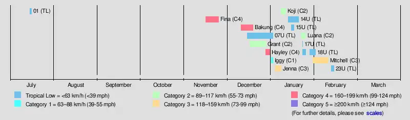
The season began with a tropical low in TCWC Jakarta's area of responsibility on 15 July. It was the first July tropical low in the Australian region since 2022. It moved into the South-West Indian Ocean a day later. The first tropical cyclone of the season, Fina, formed in the Timor Sea on 18 November.[1] Fina quickly intensified to a Category 4 peak before landfall on the western part of the Northern Territory. This was followed by Bakung, which also became a Category 4 Severe Tropical Cyclone on 14 December before dissipating, looping around in the northwestern part of the basin, away from land. After that, Grant developed, and slowly intensified before leaving the basin on 27 December. The same day, Hayley developed. It struck Kimberley a few days later, weakening from its Category 4 peak. To continue the quick formation of storms, Iggy was a short-lived Category 1 system well away from land in early January, before Jenna also curved westward a few days later, as a Category 3. The Australian region has seen an unusually active start to the season, with six named systems forming or entering Australia's western region by 6 January, making it the most active in the region to said point since the 1973-74 season.[2]
Peak season activity
Continuing with a very active streak, Koji was a weaker system that impacted Queensland in mid–January. After a short break, Luana formed and struck near Broome on 25 January, before continuing inland via a brown ocean effect. In early February, Mitchell developed and paralleled the Pilbara coast before making landfall on 9 February.
Oceanic conditions

The Indian Ocean Dipole reached -1.94°c in the week ending 2 November, which was the lowest weekly ever recorded in records to 2008.[3] A negative IOD influences tropical cyclone development in the Indian Ocean, as it leads to warmer water near Australia.[4]
Systems
Tropical Low 01
| Tropical low (BMKG) | |
  | |
| Duration | 15 July – 16 July (Exited basin) |
|---|---|
| Peak intensity | 55 km/h (35 mph) (10-min); 1003 hPa (mbar) |
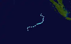
On 15 July, a low-pressure area that had developed out of an equatorial trough which interacted with the Madden-Julian Oscillation gained better characteristics, thus it was noted as the first tropical low, in the area of responsibility of TCWC Jakarta.[5] It was the first July tropical low in the Australian region since 2022. As the system slowly intensified in an area of warm SSTs offset by high wind shear, a TCFA was issued by the JTWC, shortly before the system exited into the South-West Indian Ocean basin on 16 July, where it was designated Tropical Depression 01 by MFR.
Severe Tropical Cyclone Fina
| Category 4 severe tropical cyclone (Australian scale) | |
| Category 4 tropical cyclone (SSHWS) | |
  | |
| Duration | 15 November – 24 November |
|---|---|
| Peak intensity | 195 km/h (120 mph) (10-min); 938 hPa (mbar) |
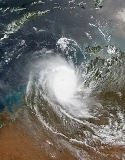
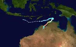
On 15 November, the Bureau of Meteorology started tracking a low-pressure system near the Timor Sea and designated it as 02U.[6] On 18 November, the system developed stronger convection and thunderstorm activity.[7] It intensified into Tropical Cyclone Fina on the same day and remained a compact system.[8] On 19 November, Fina intensified into a Category 2 cyclone amid warm sea surface temperatures.[9] A cyclone warning was issued from the Coburg Peninsula to Warruwi, and a cyclone watch was issued for the Tiwi Islands, Maningrida, and Milingimbi Island.[10] Curved banding was visible early on 20 November as Fina began moving south towards the Top End.[11] Fina weakened later that day as it continued moving south due to wind shear, and its convection decreased.[12] It slightly re-intensified that evening as it moved towards Darwin.[13] Fina made landfall on the Coburg Peninsula on 21 November and further intensified as it moved into the Van Diemen Gulf.[14][15] Early on 22 November, Fina strengthened into a Category 3 severe tropical cyclone.[16] Fina made its second landfall on Melville Island that morning, with an eye being visible on satellite imagery.[17] The cyclone slightly weakened but maintained category 3 intensity that afternoon as it emerged into the Timor Sea, and its eye became less defined following the interaction with land.[18] On 23 November, Fina strengthened into a category 4 cyclone, with a clearly visible eyewall persisting on radar imagery and a minimum central pressure of 952 hPa (28.1 inHg).[19]
On 19 November, a cyclone warning was issued from the Cobourg Peninsula to Warruwi, and a cyclone watch was issued for the Tiwi Islands, Maningrida, and Milingimbi Island.[20] On 1:09 am ACST on Friday 21 November 2025, the Northern Territory Emergency Service issued cyclone warnings for part of the Northern Territory.[21] The Darwin Airport closed at 9 AM ACST in preparation for the cyclone, and shelves were empty in some stores across Darwin as major supermarkets were advised to close across the region. The local hospital, Royal Darwin Hospital, issued a code brown to streamline emergency management systems.[22] The strongest wind gusts were recorded were around 109 km/h at Crocker Island Airport on 21 November, and 107 km/h in 22 November. The most notable 24-hour rainfall recorded from Fina was at Middle Point, near Darwin, which would record 430 millilitres in the 24 hours to the morning of 23 November.[23] Across 22 and 23 November, the system caused several significant power outages, including large parts of Darwin, Palmerston, and the Tiwi Islands, affecting at least 19,500 customers.[24][25] Roads were flooded, and properties were damaged.[26] Hundreds of trees fell across Darwin, damaging cars and homes, while parts of the Royal Darwin Hospital's external wall collapsed.[27][28]
Severe Tropical Cyclone Bakung
| Category 4 severe tropical cyclone (Australian scale) | |
| Category 1 tropical cyclone (SSHWS) | |
  | |
| Duration | 10 December – 18 December |
|---|---|
| Peak intensity | 165 km/h (105 mph) (10-min); 957 hPa (mbar) |
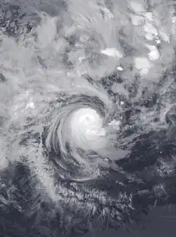
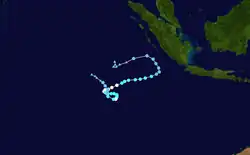
On 10 December, a low pressure area formed to the south of the city of Jakarta. Although the system was outside its area of responsibility at the time, the Bureau of Meteorology designated it Tropical Low 05U. 05U then began moving southwest, and began to consolidate and wrap deep convection near its center, and was named Bakung by TCWC Jakarta on 12 December.[29] The cyclone developed rapidly in an environment of low wind shear, reaching its peak intensity as a category 4 on 14 December, and had moved into the Australian area of responsibility. High wind shear led to a weakening of the system during 15–16 December, before easing and allowing Bakung to intensify to a category 3 early 17 December. The wind shear then rapidly increased, weakening the system to a tropical low before dissipating on 18 December.[30]
Tropical Cyclone Grant
| Category 2 tropical cyclone (Australian scale) | |
| Tropical storm (SSHWS) | |
  | |
| Duration | 16 December – 27 December (Exited basin) |
|---|---|
| Peak intensity | 100 km/h (65 mph) (10-min); 986 hPa (mbar) |
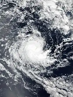
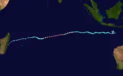
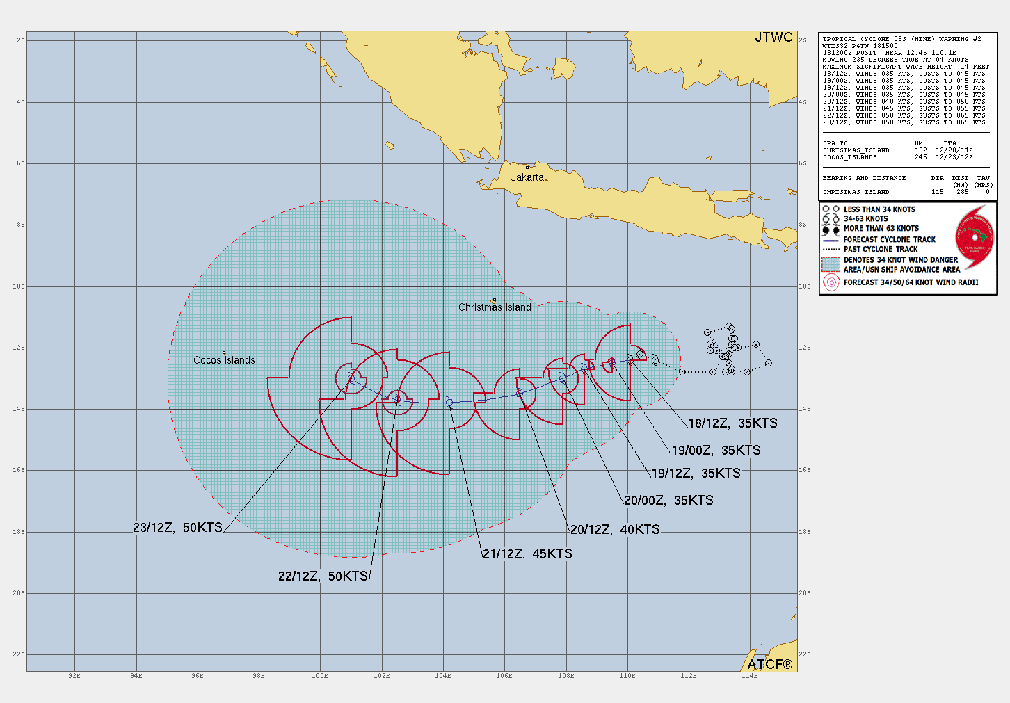
On 16 December, a tropical disturbance formed 600km south-southwest of Surabaya, Indonesia.[note 1] 6 days later, on 17 December, the storm started gradually strengthening and tracking west at about 1.4km/h.[31] At 3am UTC on 19 December, the Joint Typhoon Warning Center put out a warning and forecast estimating the storm would become a tropical cyclone in the next 48 hours.[32] On 25 December, the cyclone passed to the north of the Cocos (Keeling) Islands. When Grant passed by the Cocos (Keeling) Islands, it brought heavy rainfall and wind.[33] By 27 December, Grant had exited the basin.[34]
Severe Tropical Cyclone Hayley
| Category 4 severe tropical cyclone (Australian scale) | |
| Category 2 tropical cyclone (SSHWS) | |
  | |
| Duration | 27 December – 30 December |
|---|---|
| Peak intensity | 165 km/h (105 mph) (10-min); 952 hPa (mbar) |
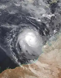
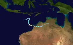
On 26 December, a tropical low formed northwest of Broome, which was designated 08U by the Bureau of Meteorology. JTWC upgraded it to a tropical cyclone on 29 December[35], and the BOM followed suit later that day, naming it Hayley. Soon after being named, it began a period of rapid intensification, reaching Category 4 strength early on 30 December,[36] with an eye feature becoming apparent. This was short-lived, however, as increasing shear obscured the eye and initiated weakening as the system approached the northwestern Kimberly Coast.[37] Hayley crossed the Dampier Peninsula south of Lombadina on 30 December. After crossing King Sound, Hayley moved inland over Western Australia once again and weakened below tropical cyclone strength early on 31 December.[38] Later that day, Hayley dissipated.
Portions of Western Australia received at least 300 millimetres (12 in) of rain fell in a 48 hour period, the equivalent to two to three months worth of rainfall for the region. The deluge led several rivers overflowing their banks. Flooding damaged several highways, isolating remote communities.[39] Wind gusts up to 158 kilometres per hour (98 mph) were reported in the Lombadina community.[40] North of Broome, strong winds tore off the roofs of two homes. A basketball court sustained severe damage from the storm. Water leaked through the roofs of several homes. A tree fell on a parked car in One Arm Point. [41] Another fallen tree damaged the roof of a church in Djarindjin.[42] Several communities were left without power and nine people fled to shelters.[43] A bridge was temporarily closed after a tree fell on it. After the storm, seventeen State Emergency Service volunteers were mobilized to assist with recovery efforts.[44]
Tropical Cyclone Iggy
| Category 1 tropical cyclone (Australian scale) | |
| Tropical storm (SSHWS) | |
  | |
| Duration | 31 December – 1 January |
|---|---|
| Peak intensity | 75 km/h (45 mph) (10-min); 997 hPa (mbar) |
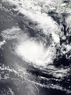
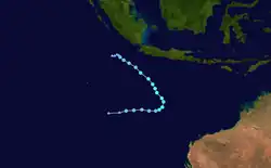
On 29 December 2025, a tropical low developed southwest of Java, Indonesia. Two days later the system developed into a category 1 cyclone on the Australian scale. On 1 January 2026, 8am AWST (UTC +8) and weakened below cyclone strength on 2 January at 2am., Iggy briefly developed into a category 1 cyclone 300km south of Christmas Island. The cyclone was compact, with a gale force wind radius reaching only 70 km. It produced heavy rainfall, totalling 151.2mm between 9 am 30 December and 9 am 1 January. The system had no reported impacts on the island.[45]
Severe Tropical Cyclone Jenna
| Category 3 severe tropical cyclone (Australian scale) | |
| Category 2 tropical cyclone (SSHWS) | |
  | |
| Duration | 3 January – 7 January (Exited basin) |
|---|---|
| Peak intensity | 150 km/h (90 mph) (10-min); 967 hPa (mbar) |
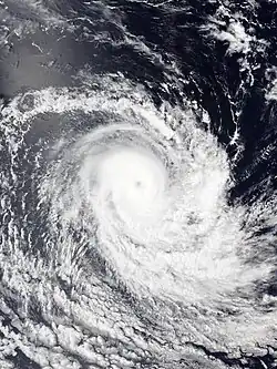
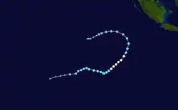
On 5 January, Jenna developed into a category 1 system to the east of the Cocos (Keeling) Islands, with the territory experiencing gale force winds.[46] While forecast to pass the islands as a tropical low, the storm rapidly intensified to category 2 strength. Residents have reported minor flooding and downed trees. It was the second cyclone to affect the islands in less than two weeks, after Tropical Cyclone Grant.[47] The system dropped below category 1 strength by 8 January, 2pm AWST (UTC+8).[48]
Tropical Cyclone Koji
| Category 2 tropical cyclone (Australian scale) | |
| Tropical storm (SSHWS) | |
  | |
| Duration | 7 January – 10 January |
|---|---|
| Peak intensity | 100 km/h (65 mph) (10-min); 989 hPa (mbar) |
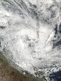
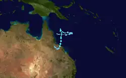
On 7 January, a broad monsoon depression formed in the Coral Sea, and was designated Tropical Low 12U.[49] The following day, the Bureau of Meteorology gave the system a moderate chance of developing into a tropical cyclone, and issued severe weather and flooding warnings for northeast Queensland.[50] On 10 January, gales began to wrap around the low, and the BoM assigned the name Koji to the cyclone, with Willis Island recording storm force winds, gusting to 133km/h.[49] Koji soon began weakening and degenerated into an ex-tropical cyclone on the morning of 11 January, shortly before moving ashore on the Queensland coast between Ayr and Bowen.[51] The system persisted as a tropical low inland over Queensland until it ultimately dissipated on 14 January.[52]
In preparation for the system, the City of Townsville conducted controlled releases of water from the Ross River Dam to reduce the flood risk.[53] A major flood warning was issued for the Pioneer River in Mirani. More than 22,000 houses in the Mackay and Whitsunday Regions lost electricity.[54] Several downed fences, trees and powerlines were reported. One woman and her children were rescued after their car was trapped in floodwaters.[55] Rough seas caused several boats to break free of their anchorages. Two men and five children were rescued from their flooded home.[56] A man was rescued after he was swept away by an overflowing river.[57] Wind gusts of 117 km/h were reported on Hamilton Island.[58] Several locations recorded very high 48 hour rainfall totals, including 601mm observed at Mount William, and several locations in the Pioneer River catchment recording 24 hour totals in excess of 350mm.[49]
Several rivers experienced major flooding, including the Pioneer, Isaac, Mackenzie, Fitzroy, Flinders and Georgina[59]. Towns that sustained major damage included Clermont, which saw up to 60 homes affected, and Eungella, which received severe damage to roads and was unable to receive food or medical supplies. Queensland Premier David Crisafulli stated that over 50,000 cattle were lost to the event, and damage assessments in the aftermath were not feasible for many people.[60] Flooded roads left more than 200 residents isolated.[61] Several rain gauges failed during the flooding, with Crisafulli calling for more investment in rain gauges.[62] Twenty five boats were destroyed by the cyclone, leaving several people homeless. One resident sustained losses of AU$200,000 (US$142,000) from the storm.[63]
Tropical Cyclone Luana
| Category 2 tropical cyclone (Australian scale) | |
| Tropical storm (SSHWS) | |
  | |
| Duration | 21 January – 24 January |
|---|---|
| Peak intensity | 95 km/h (60 mph) (10-min); 986 hPa (mbar) |
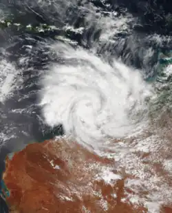
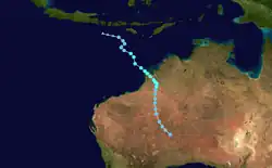
Tropical Low 16U formed near Darwin on 18 January, but weakened into a trough the following day.[64] It began to re-intensify on 22 January.[65] At 2 AM 24 January, the system reached tropical cyclone status, and was named as Luana by the BoM. Warnings were issued between Broome and Kuri Bay, and adjacent inland areas, with a potential for a category 2 strength impact. The system was the second cyclone to impact the area in less than a month, after Cyclone Hayley.[66] Luana was notable for its broad wind field and significant moisture profile; after moving inland and being downgraded to a tropical low on 25 January, the system underwent a rare brown ocean effect intensification. On 27 January, while situated over the Western Australian interior nearly 600 km inland, the low deepened and regained a symmetrical, cyclone-like structure fueled by the heat and moisture of the saturated ground.[67]
A weather station at Lombardina recorded a gust of 106 kilometres per hour (66 mph).[68] The storm caused significant structural damage to the Mercedes Cove Exclusive Coastal Retreat, where buildings were unroofed and debris was scattered.[69] In Derby, approximately 70 customers lost power, and State Emergency Service (SES) volunteers, assisted by minimum-security prisoners from the West Kimberley Regional Prison, responded to numerous calls for fallen trees blocking homes and roads.[70] Rainfall was exceptionally heavy across the region. Derby recorded 191.2 millimetres (7.53 in) of rain in a 24-hour period, while Lombardina reported a three-day total of 272.2 millimetres (10.72 in). These rains led to the closure of several major transport routes, including the Gibb River Road and Cape Leveque Road. As the remnants of Luana tracked southwards towards the Goldfields and Eucla districts, flood watches were maintained for the Salt Lake and Nullarbor river catchments.[68]
Severe Tropical Cyclone Mitchell
| Category 3 severe tropical cyclone (Australian scale) | |
| Category 2 tropical cyclone (SSHWS) | |
  | |
| Duration | 29 January – 9 February |
|---|---|
| Peak intensity | 140 km/h (85 mph) (10-min); 965 hPa (mbar) |
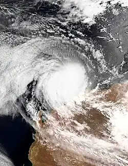
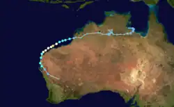
On 30 January, the Bureau of Meteorology first noted the potential for a tropical low, designated 21U, to form in the coming week.[71] Three days later, on 2 February, 21U developed into a tropical low inland over Australia's Northern Territory.[72] Moving east, the system eventually emerged over water on 5 February and intensified into a category one system the next day, receiving the name Mitchell.[73] The cyclone reached category 3 status on the Australian scale, as it paralleled the Western Australian coastline.[74] Residents of Coral Bay and Carnarvon were told to shelter from the storm's destructive winds and heavy rainfall, with Exmouth further north sustaining minimal damage.[75]
Uprooted trees, damaged street signs, and minor flooding were reported as Mitchell paralleled the Pilbara coast.[76] Shark Bay recorded up to 103.6 millimetres (4.08 in) of rain and Legendre Island recorded a maximum wind gust of 169 kilometres per hour (105 mph).[77] Banana farmers in Perth lost around half of their crops.[78] Remnant moisture from Mitchell fueled severe thunderstorms in the Wheatbelt and Goldfields regions. Strong winds ripped doors off of buildings and caused a few silos to collapse.[79] In Exmouth, nearly 2,000 properties were left without power.[80] Emergency services reported around twenty calls involving property damage and requests for assistance.[81] Additionally, the closure of ports from the cyclone temporarily disrupted iron ore exports.[82]
Other systems
- Tropical Low 07U formed over the Arafura Sea on 15 December.[31] It continued to move erratically until 29 December, when it promptly degenerated just over the Northern Territory. The system produced rainfall exceeding 100 mm in the Gulf of Carpentaria, including 148mm at Centre Island.[83]
- Tropical Low 14U formed near the Solomon Islands on 12 January. It left the Australian region and moved into the South Pacific on 19 January, being redesignated as 05F by the Fiji Meteorological Service.
- Tropical Low 15U formed near the coast of Western Australia on 14 January, and was given a low chance of developing into a tropical cyclone.[84] The Bureau of Meteorology ceased tracking the system on 16 January.[85]
- On January 21, the JTWC began monitoring Tropical Cyclone 16P in the far eastern reaches of the basin. Hours later, it moved into the South Pacific, where it was classified as Tropical Depression 06F.[86]
- Tropical Low 17U formed in Coral Sea on 22 January. However, it dissipated over the open ocean late at night, on the same day. On January 27, 17U’s remnants regenerated and became Tropical Depression 07F.
- Tropical Low 18U formed in the Gulf of Carpentaria on 22 January. It quickly made landfall on the Cape York Peninsula before dissipating on 24 January. However, on 27 January, the Bureau of Meteorology began tracking a possible redevelopment of the system as it was expected to move back into the Gulf of Carpentaria in the following days. 18U strengthened once again as a tropical low on 29 January and stop tracked by BoM on 31 January. Later, its remnant low redeveloped over the Northern Territory. The system caused rainfalls of 300-500 meters, with Daly River being evacuated ahead of forecast major flooding.[87]
- Tropical Low 23U formed in Coral Sea on 11 February, BoM stop tracked the system as it weakened into disturbance on February 13.
Storm names
Bureau of Meteorology
The Australian Bureau of Meteorology (TCWC Melbourne) monitors all tropical cyclones that form within the Australian region, including any within the areas of responsibility of TCWC Jakarta or TCWC Port Moresby.[88] Should a tropical low reach tropical cyclone strength within the BoM's area of responsibility, it will be assigned the next name from the following naming list. The names Hayley, Jenna and Luana were used for the first time this season, after replacing Heidi, Jasmine and Lua respectively, from the 2011–12 season. Additionally, the names Oran and Riordan replaced Oswald and Rusty after they were retired at the end of the 2012–13 season, but are currently unused. The names that will be used for the 2025–26 season are listed below:
|
|
|
TCWC Jakarta
TCWC Jakarta monitors tropical cyclones from the equator to 11°S and from 90°E to 145°E. Should a tropical depression reach tropical cyclone strength within TCWC Jakarta's area of responsibility, it would be assigned the next name from the list below.[88]
|
|
TCWC Port Moresby
Tropical cyclones that develop north of 11°S between 151°E and 160°E are assigned names by the Tropical Cyclone Warning Centre in Port Moresby, Papua New Guinea. Tropical cyclone formation in this area is rare, with no cyclones being named in it since 2007.[89] As names are assigned in a random order, the whole list is shown below:
|
|
Season effects
This table lists all of the tropical cyclones and subtropical cyclones that were monitored during the 2025–2026 Australian region cyclone season. Information on their intensity, duration, name, areas affected, primarily comes from RSMC Australia. Death and damage reports come from either press reports or the relevant national disaster management agency while the damage totals are given in 2025 or 2026 USD.
| Name | Dates | Peak intensity | Areas affected | Damage (US$) |
Deaths | |||
|---|---|---|---|---|---|---|---|---|
| Category | Wind speed (km/h (mph)) |
Pressure (hPa) | ||||||
| TL | 15–16 Jul | Tropical low | 55 (35) | 1003 | None | None | 0 | |
| Fina | 15–24 Nov | Category 4 severe tropical cyclone | 195 (120) | 938 | Timor-Leste, Indonesia (Lesser Sunda Islands), Tiwi Islands, Northern Territory, Kimberley | Unknown | 0 | |
| Bakung | 10–18 Dec | Category 4 severe tropical cyclone | 165 (105) | 957 | Indonesia (Sumatra) | None | 0 | |
| 07U | 14 Dec – 1 Jan | Tropical low | Not specified | 1005 | Northern Territory (particularly East Arnhem, Katherine), Far North Queensland | Minor | 0 | |
| Grant | 16–27 Dec | Category 2 tropical cyclone | 100 (65) | 986 | Indonesia (Java), Christmas Island, Cocos Islands (Before crossover) | Unknown | 0 | |
| Hayley | 27–30 Dec | Category 4 severe tropical cyclone | 165 (105) | 952 | Indonesia (Lesser Sunda Islands), Kimberley, Northern Territory | Unknown | 0 | |
| Iggy | 31 Dec – 1 Jan | Category 1 tropical cyclone | 75 (45) | 997 | Indonesia (Sumatra, Java), Christmas Island | Unknown | 0 | |
| Jenna | 3–7 Jan | Category 3 severe tropical cyclone | 150 (90) | 967 | Cocos Islands (Before crossover) | Minor | 0 | |
| Koji | 7–10 Jan | Category 2 tropical cyclone | 100 (65) | 989 | Papua New Guinea, Coral Sea Islands, Queensland | ≥$142,000 | 0 | |
| 14U | 12–19 Jan | Tropical low | Not specified | 993 | Solomon Islands (Before crossover) | Unknown | 0 | |
| 15U | 14–16 Jan | Tropical low | Not specified | 1004 | None | None | 0 | |
| Luana | 21–24 Jan | Category 2 tropical cyclone | 95 (60) | 986 | Northern Territory (particularly Western Top End), Western Australia (particularly Kimberley, Pilbara, Goldfields–Esperance), Indonesia (Lesser Sunda Islands) | Unknown | 0 | |
| 17U | 22 Jan | Tropical low | Not specified | 1002 | Coral Sea Islands (Before crossover) | None | 0 | |
| 18U | 22–31 Jan | Tropical low | Not specified | 998 | Queensland, Northern Territory (particularly Top End) | Minor | 0 | |
| Mitchell | 29 Jan – 9 Feb | Category 3 severe tropical cyclone | 140 (85) | 965 | Northern Territory, Western Australia | Unknown | 0 | |
| 23U | 11–13 Feb | Tropical low | Not specified | 1001 | Coral Sea Islands | None | 0 | |
| Season aggregates | ||||||||
| 16 systems | 15 Jul – Present | 195 (120) | 938 | Unknown | 0 | |||
See also
- Weather of 2025 and 2026
- List of Southern Hemisphere cyclone seasons
- Tropical cyclones in 2025, 2026
- Atlantic hurricane seasons: 2025, 2026
- Pacific hurricane seasons: 2025, 2026
- Pacific typhoon seasons: 2025, 2026
- North Indian Ocean cyclone seasons: 2025, 2026
- 2025–26 South-West Indian Ocean cyclone season
- 2025–26 South Pacific cyclone season
Notes
References
- ^ "Tropical Cyclone Fina 02U at 1800 UTC". Bureau of Meteorology. 18 November 2025. Archived from the original on 18 November 2025. Retrieved 18 November 2025.
- ^ "Severe Tropical Cyclone Jenna continues active start to Australian cyclone season". www.weatherzone.com.au. 6 January 2026. Retrieved 7 January 2026.
- ^ "Annual Statement 2025". Bureau of Meteorology. 9 February 2026. Retrieved 10 February 2026.
- ^ "Transparency Portal". www.transparency.gov.au. Retrieved 10 February 2026.
- ^ "TCWC Jakarta - Badan Meteorologi, Klimatologi, dan Geofisika". tropicalcyclone.bmkg.go.id. Retrieved 16 July 2025.
- ^ "BOM forecasts high chance of a cyclone off the NT, potentially impacting Darwin". ABC News. 17 November 2025. Retrieved 18 November 2025.
- ^ "Tropical Low 02U at 1200 UTC". Bureau of Meteorology. 18 November 2025. Archived from the original on 18 November 2025. Retrieved 18 November 2025.
- ^ "Tropical Cyclone Fina 02U at 1800 UTC". Bureau of Meteorology. 18 November 2025. Archived from the original on 18 November 2025. Retrieved 18 November 2025.
- ^ "Tropical Cyclone Fina 02U at 1200 UTC". Bureau of Meteorology. 19 November 2025. Archived from the original on 19 November 2025. Retrieved 19 November 2025.
- ^ "Tropical Cyclone Fina is expected to turn south towards the northern Top End coast during Thursday". Bureau of Meteorology. 19 November 2025. Archived from the original on 19 November 2025. Retrieved 19 November 2025.
- ^ "Tropical Cyclone Fina 02U at 0000 UTC". Bureau of Meteorology. 20 November 2025. Archived from the original on 20 November 2025. Retrieved 20 November 2025.
- ^ "Tropical Cyclone Fina 02U at 1200 UTC". Bureau of Meteorology. 20 November 2025. Archived from the original on 20 November 2025. Retrieved 20 November 2025.
- ^ "Tropical Cyclone Fina 02U at 1800 UTC". Bureau of Meteorology. 20 November 2025. Archived from the original on 20 November 2025. Retrieved 20 November 2025.
- ^ "Cyclone Fina Best Track". Retrieved 21 November 2025.
- ^ "Tropical Cyclone Fina 02U at 1800 UTC". Bureau of Meteorology. 21 November 2025. Archived from the original on 21 November 2025. Retrieved 21 November 2025.
- ^ "Severe Tropical Cyclone Fina 02U at 0000 UTC". Bureau of Meteorology. 22 November 2025. Archived from the original on 22 November 2025. Retrieved 22 November 2025.
- ^ "Severe Tropical Cyclone Fina 02U at 0600 UTC". Bureau of Meteorology. 22 November 2025. Archived from the original on 22 November 2025. Retrieved 22 November 2025.
- ^ "Severe Tropical Cyclone Fina 02U at 1200 UTC". Bureau of Meteorology. 22 November 2025. Archived from the original on 22 November 2025. Retrieved 22 November 2025.
- ^ "Severe Tropical Cyclone Fina 02U at 1200 UTC". Bureau of Meteorology. 23 November 2025. Archived from the original on 23 November 2025. Retrieved 23 November 2025.
- ^ "Tropical Cyclone Fina is expected to turn south towards the northern Top End coast during Thursday". Bureau of Meteorology. 19 November 2025. Archived from the original on 19 November 2025. Retrieved 19 November 2025.
- ^ "Update 2: Tropical Cyclone Fina". Secure NT. 21 November 2025. Retrieved 21 November 2025.
- ^ Stock, Petra (22 November 2025). "Severe Tropical Cyclone Fina intensifies to category three system as it closes in on Darwin". the Guardian. Retrieved 22 November 2025.
- ^ "Severe Tropical Cyclone Fina". Bureau of Meteorology. 26 November 2025. Retrieved 26 November 2025.
- ^ "Outages and works". PowerWater. 23 November 2025. Archived from the original on 23 November 2025. Retrieved 23 November 2025.
- ^ "Cyclone Fina intensifies as it moves away from NT coast — as it happened". ABC News. 22 November 2025. Retrieved 23 November 2025.
- ^ McKeith, Sam (23 November 2025). "Thousands without power across Australia after Cyclone Fina batters parts of country". The Independent. Retrieved 24 November 2025.
- ^ Fitzgerald, Roxanne (25 November 2025). "Trees toppled, cars crushed and thousands without power: Tropical Cyclone Fina in pictures". ABC News. Retrieved 6 December 2025.
- ^ Garrick, Matt (29 November 2025). "Severe Tropical Cyclone Fina damage exposes need for new Royal Darwin Hospital". ABC News. Retrieved 6 December 2025.
- ^ "BMKG warns of tropical Bakung and potential 93S cyclones". Independent Observer. 13 December 2025. Retrieved 16 December 2025.
- ^ "Severe Tropical Cyclone Bakung". Bureau of Meteorology. Retrieved 31 December 2025.
- ^ a b "Tropical Climate Update". Bureau of Meteorology. 16 December 2025. Archived from the original on 19 December 2025. Retrieved 19 December 2025.
- ^ "TROPICAL CYCLONE 09S (NINE) WARNING NR 004". Joint Typhoon Warning Center. 19 December 2025. Archived from the original on 19 December 2025. Retrieved 19 December 2025.
- ^ "Christmas Day cyclone greets remote Australian islands". ABC News. 24 December 2025. Retrieved 5 January 2026.
- ^ "Tropical Cyclone Grant". Bureau of Meteorology. Retrieved 21 January 2026.
- ^ Levesque, Felix (29 December 2025). "Tropical Cyclone Hayley forms northwest of the Kimberley". www.weatherzone.com.au. Retrieved 29 December 2025.
- ^ "Queensland hit by floods, while cyclone threatens WA coast". www.abc.net.au. 29 December 2025. Retrieved 29 December 2025.
- ^ Bureau of Meteorology (30 December 2025). "Tropical Cyclone Technical Bulletin: Australia - Western Region 0000 UTC 30/12/2025". Archived from the original on 30 December 2025. Retrieved 30 December 2025.
- ^ Bureau of Meteorology (30 December 2025). "Tropical Cyclone Technical Bulletin: Australia - Western Region 2100 UTC 30/12/2025". Archived from the original on 30 December 2025. Retrieved 30 December 2025.
- ^ Kazmi, Syed (5 January 2026). "Cyclone Hayley and Multi-Region Storm Impacts: Australia to Spain". Weather Blog. Retrieved 15 February 2026.
- ^ AAP (31 December 2025). "Cyclone clean-up begins, while monsoon damage assessed". Michael West. Retrieved 15 February 2026.
- ^ "Clean-up begins after WA's north endures 'absolutely terrifying' cyclone". ABC News. 31 December 2025. Retrieved 15 February 2026.
- ^ "TC Hayley, Dampier Peninsula, WA Damage to Structures" (PDF). www.jcu.edu.au. January 2026. Retrieved 15 February 2026.
- ^ press, australian associated (31 December 2025). "Cyclone clean-up begins, while monsoon damage assessed". Canberra CityNews. Retrieved 15 February 2026.
- ^ "Remote WA communities cop brunt of tropical cyclone". PerthNow. 5 January 2026. Retrieved 15 February 2026.
- ^ "Severe Tropical Cyclone Iggy (10U)". Bureau of Meteorology. Retrieved 9 January 2026.
- ^ "Tropical Cyclone Forecast Track Map | The Bureau of Meteorology". The Bureau of Meteorology. Archived from the original on 5 January 2026. Retrieved 5 January 2026.
- ^ "Cocos Keeling Islands endure second tropical cyclone in less than two weeks". ABC News. 6 January 2026. Retrieved 6 January 2026.
- ^ "tropical cyclone technical bulletin". Bureau of Meteorology. 8 January 2026. Archived from the original on 8 January 2026. Retrieved 8 January 2026.
- ^ a b c "Tropical Cyclone Koji". Bureau of Meteorology. Retrieved 30 January 2026.
- ^ "7 day forecast". Retrieved 8 January 2026.
- ^ Cancellation of Tropical Cyclone Advice, Bureau of Meteorology, 11 January 2026, archived from the original on 11 January 2026, retrieved 11 January 2026
- ^ "Tropical Cyclone Koji". www.bom.gov.au. Bureau of Meteorology. Retrieved 13 February 2026.
- ^ "Far North Queensland braces for a deluge of rain and possible cyclone". ABC News. 7 January 2026. Retrieved 8 January 2026.
- ^ "Live updates: Tropical Cyclone Koji makes landfall in north Queensland, bringing heavy rain". Australian Broadcasting Corporation. 11 January 2026. Retrieved 11 January 2026.
- ^ Press, Australian Associated (10 January 2026). "Queensland flooding rescues after Tropical Cyclone Koji makes landfall". The Guardian. ISSN 0261-3077. Retrieved 12 January 2026.
- ^ "Intense rainfall follows ex-Tropical Cyclone Koji in sodden north Queensland". ABC News. 10 January 2026. Retrieved 12 January 2026.
- ^ "Heavy rainfall batters Queensland as ex-Cyclone Koji moves inland". ABC News. 11 January 2026. Retrieved 12 January 2026.
- ^ "Cyclone Koji wreaks havoc across North Queensland". LeadStory. 11 January 2026. Retrieved 12 January 2026.
- ^ "Ex-Tropical Cyclone Koji keeps Queensland flooded, communities isolated". www.insurancebusinessmag.com. Retrieved 1 February 2026.
- ^ "Three people rescued from central Queensland flood as ex-Cyclone Koji moves west". ABC News. 12 January 2026. Retrieved 13 January 2026.
- ^ "Ex-Tropical Cyclone Koji keeps Queensland flooded, communities isolated". www.insurancebusinessmag.com. Retrieved 14 January 2026.
- ^ "Blame game begins over faulty Queensland rain gauges". ABC News. 12 January 2026. Retrieved 13 January 2026.
- ^ "Boaties left homeless by Tropical Cyclone Koji begin long rebuild". ABC News. 4 February 2026. Retrieved 15 February 2026.
- ^ "Tropical cyclone 7 day forecast". www.bom.gov.au. Bureau of Meteorology. 19 January 2026. Archived from the original on 19 January 2026. Retrieved 19 January 2026.
- ^ "Tropical Cyclone Forecast Track Map". Bureau of Meteorology. 22 January 2026. Archived from the original on 22 January 2026. Retrieved 22 January 2026.
- ^ "Tropical Cyclone Luana intensifies off northern Western Australia". ABC News. 23 January 2026. Retrieved 24 January 2026.
- ^ https://www.weatherzone.com.au/news/extropical-cyclone-luana-intensifies-over-central-australia/1891166
- ^ a b Pearman, Harley (27 January 2026). "Tropical Cyclone Launa Crosses the Coast near Broome - Saturday and Sunday 24 and 25 January 2026". Extreme Storms. Retrieved 15 February 2026.
- ^ "Roof ripped off home in northern WA by Tropical Cyclone Luana". ABC News. 25 January 2026. Retrieved 15 February 2026.
- ^ "Residents wake up to assess damage from Tropical Cyclone Luana". ABC News. 24 January 2026. Retrieved 15 February 2026.
- ^ "Tropical cyclone 7 day forecast". www.bom.gov.au. Bureau of Meteorology. 30 January 2026. Archived from the original on 30 January 2026. Retrieved 6 February 2026.
- ^ "Tropical cyclone 7 day forecast". www.bom.gov.au. Bureau of Meteorology. 2 February 2026. Archived from the original on 2 February 2026. Retrieved 6 February 2026.
- ^ "Residents readying for wild weather as Tropical Cyclone Mitchell intensifies off WA coast". ABC News. 6 February 2026. Retrieved 7 February 2026.
- ^ "Severe Tropical Cyclone Mitchell forecast to make landfall as residents sleep". www.9news.com.au. 8 February 2026. Retrieved 11 February 2026.
- ^ "Tropical Cyclone Mitchell downgraded to category one system". ABC News. 8 February 2026. Retrieved 11 February 2026.
- ^ "Tropical Cyclone Mitchell Causes Damage and Disruptions Along Western Australia's Pilbara Coast - SSBCrack News". 8 February 2026. Retrieved 15 February 2026.
- ^ "Gascoyne coast bruised but not battered by Mitchell". Midwest Times. 10 February 2026. Retrieved 15 February 2026.
- ^ "Banana crop skinned as weakening storm heads south". Yahoo News. 10 February 2026. Retrieved 15 February 2026.
- ^ "WA farmers count cost of strong winds but welcome rain". ABC News. 11 February 2026. Retrieved 15 February 2026.
- ^ "Weekly Cat Report Review of Global Catastrophe Activity February 13, 2026" (PDF). img.clients.aonunited.com. 13 February 2026. Retrieved 15 February 2026.
- ^ Kothari, Rishav (10 February 2026). "Tropical Cyclone Mitchell causes thousands of power outages in Western Australia". The Watchers. Retrieved 15 February 2026.
- ^ "Pilbara ports brace & reopen after tropical cyclone Mitchell disrupts Iron Ore exports". logisticswall.com. 9 February 2026. Retrieved 15 February 2026.
- ^ "Tropical Climate Update". www.bom.gov.au. 23 December 2025. Archived from the original on 19 December 2025. Retrieved 29 December 2025.
- ^ "Tropical cyclone 7 day forecast". www.bom.gov.au. Bureau of Meteorology. 14 January 2026. Archived from the original on 14 January 2026. Retrieved 16 January 2026.
- ^ "Tropical cyclone 7 day forecast". www.bom.gov.au. Bureau of Meteorology. 16 January 2026. Archived from the original on 16 January 2026. Retrieved 16 January 2026.
- ^ "Joint Typhoon Warning Center (JTWC)". www.metoc.navy.mil. Retrieved 21 January 2026.
- ^ "Hundreds of NT residents to be evacuated ahead of 14 metre flooding levels". ABC News. 4 February 2026. Retrieved 4 February 2026.
- ^ a b RA V Tropical Cyclone Committee (2023). Tropical Cyclone Operational Plan for the South-East Indian Ocean and the Southern Pacific Ocean 2023 (PDF) (Report). World Meteorological Organization. Archived from the original (PDF) on 2 July 2024. Retrieved 23 October 2023.
- ^ Gary Padgett (2008). "Monthly Global Tropical Cyclone Summary October". Australian Severe Weather. Archived from the original on 4 July 2013. Retrieved 1 July 2013.
External links
