2025–26 South Pacific cyclone season
| 2025–26 South Pacific cyclone season | |
|---|---|
 Season summary map | |
| Seasonal boundaries | |
| First system formed | 2 December 2025 |
| Last system dissipated | Season ongoing |
| Strongest storm | |
| Name | 05F & 06F |
| • Lowest pressure | 994 hPa (mbar) |
| Seasonal statistics | |
| Total disturbances | 8 |
| Total depressions | 4 |
| Tropical cyclones | 0 |
| Severe tropical cyclones | 0 |
| Total fatalities | 9 |
| Total damage | Unknown |
| Related articles | |
The 2025–26 South Pacific cyclone season is an ongoing cyclone season in the South Pacific Ocean to the east of 160°E. The season officially started on 1 November 2025, and will end on 30 April 2026; however a tropical cyclone could form at any time between 1 July 2025, and 30 June 2026, and would count towards the season total. During the season, tropical cyclones will be officially monitored by the Fiji Meteorological Service, Australian Bureau of Meteorology and New Zealand's MetService. The United States Armed Forces through the Joint Typhoon Warning Center (JTWC) will also monitor the basin and issue unofficial warnings for American interests. The FMS attaches a number and an F suffix to tropical disturbances that form in or move into the basin while the JTWC designates significant tropical cyclones with a number and a P suffix. The BoM, FMS and MetService all use the Australian Tropical Cyclone Intensity Scale and estimate windspeeds with a period of approximately ten minutes, while the JTWC estimates sustained winds over a 1-minute period, which are subsequently compared to the Saffir–Simpson hurricane wind scale (SSHWS).
Seasonal forecasts
| Source/Record | Region | Tropical Cyclone |
Severe Tropical Cyclones |
Ref |
|---|---|---|---|---|
| Records | ||||
| Average (1969–70 – 2024–25): | 160°E – 120°W | 7 | 3 | [1] |
| Record high: | 160°E – 120°W | 1997–98: 16 | 1982–83: 9 | [2] |
| Record low: | 160°E – 120°W | 1990–91: 2 | 2008–09: 0 | [2] |
| Predictions | ||||
| ESNZ October | 135°E – 120°W | 5–9 | 2–4 | [3] |
| FMS Whole | 160°E – 120°W | 4–5 | 1–3 | [1] |
| FMS Western | 160°E – 180° | 2–3 | 1–2 | [1] |
| FMS Eastern | 180° – 120°W | 2–3 | 0–1 | [1] |
Ahead of the season officially starting on 1 November, the Fiji Meteorological Service (FMS) and Earth Sciences New Zealand (ESNZ), both issued a tropical cyclone outlook that discussed the upcoming season.[1][3] These outlooks took into account a variety of factors such as a developing weak to moderate La Niña event and what had happened in previous seasons such as 1980–81, 1983–84, 1984–85, 1995–96, 2000–01, 2001–02, 2003–04, 2005–06, 2008–09, 2011–12, 2012–13, 2016–17, 2017–18, 2020–21 and 2021–22.[1][3] The Southwest Pacific tropical cyclone outlook issued by Earth Sciences New Zealand (ESNZ) in conjunction with MetService and various other Pacific meteorological services, predicted that five to nine tropical cyclones would occur over the South Pacific Ocean between 135°E and 120°W.[3] The outlook also predicted that two to four of these tropical cyclones would intensify further and become either a Category three, four or five severe tropical cyclone on the Australian tropical cyclone intensity scale.[3] In addition to contributing towards the Southwest Pacific tropical cyclone outlook, the FMS predicted that four or five tropical cyclones would occur within the basin, while one to three of these tropical cyclones were expected to intensify further and become either a category three, four or five severe tropical cyclone on the Australian scale.[1]
Seasonal summary
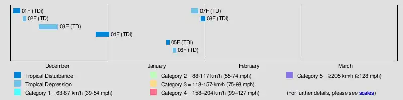
Systems
Tropical Disturbance 01F
| Tropical disturbance (Australian scale) | |
| Tropical storm (SSHWS) | |
  | |
| Duration | 2 December – 4 December |
|---|---|
| Peak intensity | 85 km/h (50 mph) (1-min); 999 hPa (mbar) |
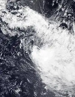
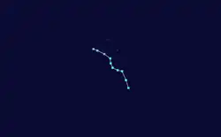
On 2 December, a subtropical cyclone formed and was tracked by JTWC and tracked southeastward. Due to an unfavorable environment, the storm degenerated and then dissipated without being named 2 days later.
Tropical Depression 02F
| Tropical depression (Australian scale) | |
| Tropical storm (SSHWS) | |
  | |
| Duration | 5 December – 6 December |
|---|---|
| Peak intensity | 75 km/h (45 mph) (1-min); 1000 hPa (mbar) |
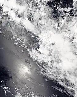
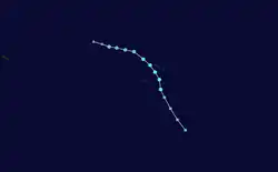
On 5 December, JTWC started monitoring Tropical Cyclone 06P, embedded within the South Pacific Convergence Zone, 216 nmi north of Papeete, Tahiti. The cyclone was extremely compact and had rapidly consolidated over the preceding 24 hours.[4] Later that day, FMS identified the cyclone as Tropical Disturbance 02F and noted the potential for strengthening in a favorable environment with low vertical wind shear and warm sea surface temperatures.[5] 02F was upgraded to a tropical depression by FMS on late night of 5 December, but the system quickly came under the influence of moderate shear which exposed the system's low-level circulation center.[6] JTWC ceased warnings later that day and downgraded the cyclone to a subtropical depression. The depression was last noted on 6 December, as the sheared system accelerated southeastward.[7]
Tropical Depression 03F
| Tropical depression (Australian scale) | |
| Tropical storm (SSHWS) | |
  | |
| Duration | 10 December – 16 December |
|---|---|
| Peak intensity | 75 km/h (45 mph) (1-min); 1000 hPa (mbar) |
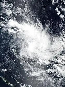
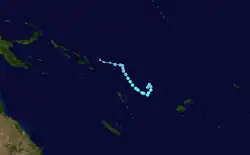
Tropical Depression 03F was designated just east of the Solomon Islands by the Fiji Meteorological Service on 10 December.[8]
Tropical Disturbance 04F
| Tropical disturbance (Australian scale) | |
| Subtropical depression (SSHWS) | |
  | |
| Duration | 28 December – 1 January |
|---|---|
| Peak intensity | 45 km/h (30 mph) (1-min); 1001 hPa (mbar) |
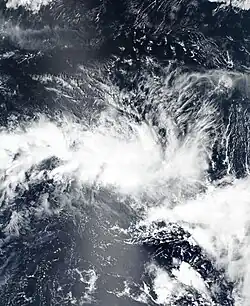
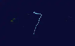
Tropical Disturbance 04F developed north of Samoa on 28 December.[9]
Tropical Disturbance 05F
| Tropical disturbance (Australian scale) | |
| Subtropical storm (SSHWS) | |
  | |
| Duration | 19 January (Entered basin) – 20 January |
|---|---|
| Peak intensity | 65 km/h (40 mph) (1-min); 994 hPa (mbar) |
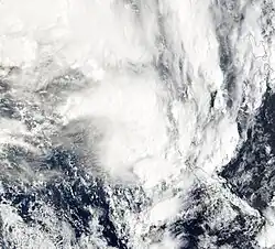
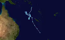
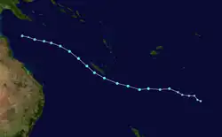
Tropical Low 14U entered the South Pacific basin from the Australian region late on the night of 19 January. It was designated Tropical Disturbance 05F by the Fiji Meteorological Service upon crossover. On 21 January, the system transitioned into an extratropical cyclone and had severe impacts in northern New Zealand. MetService issued Red Warnings for heavy rainfall in some regions of the North Island.[10] Nine people are confirmed or presumed dead.[11][12]
Tropical Depression 06F
| Tropical depression (Australian scale) | |
| Tropical storm (SSHWS) | |
  | |
| Duration | 21 January – 22 January |
|---|---|
| Peak intensity | 75 km/h (45 mph) (1-min); 994 hPa (mbar) |
Tropical Depression 07F
| Tropical depression (Australian scale) | |
| Tropical storm (SSHWS) | |
  | |
| Duration | 27 January (Entered basin) – 29 January |
|---|---|
| Peak intensity | 100 km/h (65 mph) (1-min); 998 hPa (mbar) |
Tropical Disturbance 08F
| Tropical disturbance (Australian scale) | |
 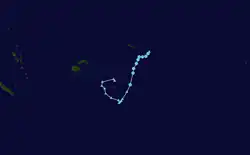 | |
| Duration | 30 January – 31 January |
|---|---|
| Peak intensity | Winds not specified; 1000 hPa (mbar) |
Storm names
Within the Southern Pacific, a tropical depression is judged to have reached tropical cyclone intensity should it reach winds of 65 km/h (40 mph) and it is evident that gales are occurring at least halfway around the center. Tropical depressions intensifying into a tropical cyclone between the Equator and 26°S and between 160°E and 120°W are named by the FMS; should a tropical depression intensify to the south of 26°S between 160°E and 120°W it will be named in conjunction with the FMS by MetService. Should a tropical cyclone move out of the basin and into the Australian region it will retain its original name. The names that will be used for the 2025–26 season are listed below:.[13] The names from Urmil to Becky are from the same list used for tropical cyclones in the 2005–06 and 2006–07 seasons.
|
|
Season effects
This table lists all the storms that developed in the South Pacific to the east of longitude 160°E during the 2025–26 season. It includes their intensity on the Australian tropical cyclone intensity scale, duration, name, landfalls, deaths, and damages. All data is taken from RSMC Nadi and/or TCWC Wellington, and all of the damage figures are in 2025 or 2026 USD.
| Name | Dates | Peak intensity | Areas affected | Damage (USD) |
Deaths | Ref(s). | ||
|---|---|---|---|---|---|---|---|---|
| Category | Wind speed | Pressure | ||||||
| 01F | December 2 – 4 | Tropical disturbance | Not specified | 999 hPa (29.50 inHg) | French Polynesia | None | None | |
| 02F | December 5 – 6 | Tropical depression | Not specified | 1000 hPa (29.53 inHg) | French Polynesia | None | None | |
| 03F | December 10 – 16 | Tropical depression | Not specified | 1000 hPa (29.53 inHg) | Solomon Islands, Vanuatu, Fiji | Unknown | None | |
| 04F | December 28, 2025 – January 1, 2026 | Tropical disturbance | Not specified | 1001 hPa (29.56 inHg) | American Samoa, Samoa | Unknown | None | |
| 05F | January 19 – 20 | Tropical disturbance | Not specified | 994 hPa (29.35 inHg) | Solomon Islands, Vanuatu, New Caledonia, Norfolk Island, New Zealand (After crossover) | Unknown | 9 | |
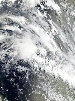
| 06F | January 21 – 22 | Tropical depression | Not specified | 994 hPa (29.35 inHg) | New Caledonia | None | None | |
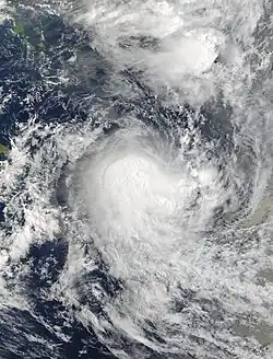
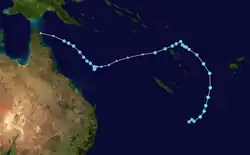
| 07F | January 27 – 29 | Tropical depression | Not specified | 998 hPa (29.47 inHg) | Solomon Islands, Vanuatu, Fiji, Norfolk Island, New Zealand (After crossover) | Unknown | None | |
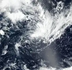
| 08F | January 30 – 31 | Tropical disturbance | Not specified | 1000 hPa (29.53 inHg) | American Samoa, Samoa, Niue, Tonga | Unknown | None | |
| Season aggregates | ||||||||
| 8 systems | 2 December 2025 – Season ongoing | 0 km/h (0 mph) | 994 hPa (29.35 inHg) | Unknown | 9 | |||
See also
- Weather of 2025 and 2026
- List of Southern Hemisphere cyclone seasons
- Tropical cyclones in 2025 and 2026
- Atlantic hurricane seasons: 2025, 2026
- Pacific hurricane seasons: 2025, 2026
- Pacific typhoon seasons: 2025, 2026
- North Indian Ocean cyclone seasons: 2025, 2026
- 2025–26 South-West Indian Ocean cyclone season
- 2025–26 Australian region cyclone season
References
- ^ a b c d e f g "Regional Specialised Meteorological Centre Nadi – Tropical Cyclone Centre (RSMC Nadi – TCC) Tropical Cyclone Seasonal Outlook 2025–26 Detailed Outlook" (PDF). Fiji Meteorological Service. 9 October 2025. Archived from the original (PDF) on 9 October 2025. Retrieved 10 October 2025.
- ^ a b Tropical Cyclone Guidance for Season 2010/11 for the Fiji and the Southwest Pacific (PDF) (Report). Fiji Meteorological Service. 26 October 2010. Archived (PDF) from the original on 19 May 2024. Retrieved 19 May 2024.
- ^ a b c d e 2025-26 Southwest Pacific Tropical Cyclone Outlook (PDF) (Report). Earth Sciences New Zealand. 8 October 2025. Archived (PDF) from the original on 9 October 2025. Retrieved 10 October 2025.
- ^ https://archive.today/20251205041927/https://www.metoc.navy.mil/jtwc/products/sh0626prog.txt
- ^ https://archive.today/20251205144014/https://www.wis-jma.go.jp/d/o/NFFN/Alphanumeric/Warning/Warnings_and_weather_summary/20251205/090000/A_WWPS21NFFN050900_C_RJTD_20251205094422_247.txt
- ^ "Tropical Disturbance Summary Dec 052240 UTC". Fiji Meteorological Service. 5 December 2025. Archived from the original on 6 December 2025. Retrieved 28 December 2025.
- ^ "Tropical Disturbance Summary Dec 062226 UTC". Fiji Meteorological Service. 7 December 2025. Archived from the original on 6 December 2025. Retrieved 28 December 2025.
- ^ Fiji Meteorological Service (11 December 2025). 5-Day Tropical Cyclone Outlook (PDF) (Report). Fiji Meteorological Service. Retrieved 11 December 2025.
- ^ Fiji Meteorological Service (28 December 2025). "Tropical Disturbance Summary Dec 282227 UTC". Fiji Meteorological Service. Archived from the original on 28 December 2025. Retrieved 28 December 2025.
- ^ https://www.1news.co.nz/2026/01/21/threat-to-life-red-heavy-rain-warnings-for-north-island-regions/
- ^ "Body found in search for man swept away by river north of Auckland". 1News. Retrieved 24 January 2026.
- ^ "'A profound tragedy': Two dead after early morning Pāpāmoa slip". 1News. Retrieved 24 January 2026.
- ^ RA V Tropical Cyclone Committee (2023). Tropical Cyclone Operational Plan for the South-East Indian Ocean and the Southern Pacific Ocean 2023 (PDF) (Report). World Meteorological Organization. Archived from the original (PDF) on 2 July 2024. Retrieved 2 July 2024.
External links
