Songino Khairkhan
Songino Khairkhan District
Сонгинохайрхан дүүрэг ᠰᠣᠩᠭᠢᠨᠠᠬᠠᠶᠢᠷᠬᠠᠨᠲᠡᠭᠦᠷᠭᠡ | |
|---|---|
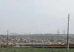 Songino Khairkhan, 2003 | |
.svg.png) Flag .svg.png) Coat of arms | |
 Songino Khairkhan in Ulaanbaatar | |
Interactive map of Songino Khairkhan District | |
| Country | Mongolia |
| Municipality | Ulaanbaatar |
| Oktyabr raion of Ulaanbaatar | 1965 |
| Reorganized as district | 1992 |
| Government | |
| • Body | Citizens' Representatives Khural of the Songino khairkhan district |
| • Governor of District | N.Altanshagai, MPP |
| Area | |
• Total | 1,200.6 km2 (463.6 sq mi) |
| Population (January 1, 2024[1]) | |
• Total | 341,390 |
| • Density | 284.35/km2 (736.46/sq mi) |
| Time zone | UTC+8 (UTC + 8) |
Songino Khairkhan (Mongolian: Сонгинохайрхан [sɔ́ŋgɪɴ‿χɛ́rχəɴ]) is one of nine districts of the Mongolian capital of Ulaanbaatar.[2] It is divided into 43 subdistricts. It is located in Ulaanbaatar's westernmost region, and encompasses one of the city's four largest mountains — the Songinokhairkhan Uul.
Administrative divisions
The district consists of 43 khoroos.[3]
Economy
The majority sector of employment in the district are construction (35%), wholesale and retail (22%) and manufacturing (15%).[3]
Demographics
As of March 2022, the district recorded a population of 335,554 people living across 89,725 households.[3]
Infrastructure
- Monnaran Solar Power Plant
- New Central Wastewater Treatment Plant
- Songino Battery Storage Power Station
- Ulaanchuluut Landfill
References
- ^ "Population, by khoroo". Statistics Department of Ulaanbaatar. Retrieved 2024-06-04.
- ^ Kamata, Takuya; Reichert, James; Tsevegmid, Tumentsogt; Kim, Yoonhee; Sedgewick, Brett (2010). Managing Urban Expansion in Mongolia: Best Practices in Scenario-Based Urban Planning. World Bank Publications. p. 3. ISBN 9780821383155.
- ^ a b c "Songinokhairkhan District: Rapid Assessment on Population, Migration and Needs" (PDF). DTM IOM Placement Tracking Matrix. July 2022. Retrieved 15 October 2025.

Wikimedia Commons has media related to Songino Khairkhan.
 | ||