On 24 October 1964, Zambia became independent of the United Kingdom as a republic in the Commonwealth, and prime minister Kenneth Kaunda became the inaugural president. Kaunda's socialistUnited National Independence Party (UNIP) maintained power from 1964 until 1991 with him playing a key role in regional diplomacy, cooperating closely with the United States in search of solutions to conflicts in Southern Rhodesia (Zimbabwe), Angola, and Namibia. From 1972 to 1991, Zambia was a one-party state with UNIP as the sole legal political party under the motto "One Zambia, One Nation" coined by Kaunda. Kaunda was succeeded by Frederick Chiluba of the social-democraticMovement for Multi-Party Democracy in 1991, beginning a period of socio-economic development and government decentralisation. Zambia has since become a multi-party state and has experienced several peaceful transitions of power.
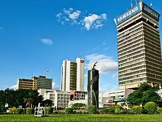
Lusaka (/luːˈsɑːkə/loo-SAH-kə) is the capital and largest city of Zambia. It is one of the fastest-developing cities in southern Africa. Lusaka is in the southern part of the central plateau at an elevation of about 1,279 metres (4,196 ft). As of 2019, the city's population was about 3.3 million, while the urban population is estimated at 2.5 million in 2018. Lusaka is the centre of both commerce and government in Zambia and connects to the country's four main highways heading north, south, east, and west. English is the official language of the city administration, while Bemba, Tonga and Nyanja are the commonly spoken street languages.
The earliest evidence of settlement in the area dates to the 6th century AD, with the first known settlement in the 11th century. It was then home to the Lenje and Soli peoples from the 17th or 18th century. The founding of the modern city occurred in 1905 when it lay in the British protectorate of Northern Rhodesia, which was controlled by the British South African Company (BSAC). The BSAC built a railway linking their mines in the Copperbelt to Cape Town and Lusaka was designated as a water stop on that line, named after a local Lenje chief called Lusaaka. White Afrikaner farmers then settled in the area and expanded Lusaka into a regional trading centre, taking over its administration. In 1929, five years after taking over control of Northern Rhodesia from the BSAC, the British colonial administration decided to move its capital from Livingstone to a more central location, and Lusaka was chosen. Town planners including Stanley Adshead worked on the project, and the city was built out over the subsequent decades. (Full article...)
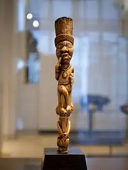
Image 2Seated female Staffs of office (Kibango), were displayed by Luba kings. In Luba society, women's bodies were considered the ultimate vessels of spiritual power. (from History of Zambia)
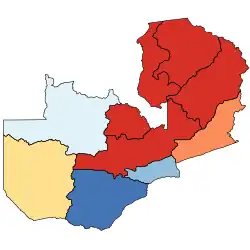
Image 3Tribal and linguistic map of Zambia (from Zambia)
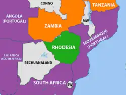
Image 5The geopolitical situation during the Rhodesian Bush War in 1965 – countries friendly to the nationalists are coloured orange (from Zambia)
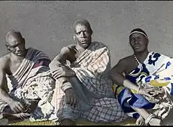
Image 6Three young Ngoni chiefs. The Ngoni made their way into Eastern Zambia from KwaZulu in South Africa. They eventually assimilated into the local ethnic groups. (from History of Zambia)
Image 7GDP per capita (current), compared to neighbouring countries (world average = 100) (from Zambia)
Image 8An 1864 photograph of the Scottish explorer and missionary David Livingstone (from Zambia)
Image 12Zambia National Assembly building in Lusaka (from Zambia)
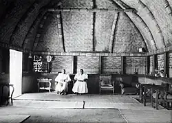
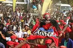
Image 13Inside the palace of the Litunga, ruler of the Lozi. Due to the flooding on the Zambezi, the Litunga has two palaces one of which is on higher ground. The movement of Litunga to higher land is celebrated at the Kuomboka Ceremony (from Zambia)
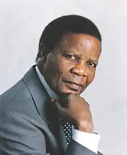
Image 14S.M Chisembele, Cabinet Minister, Western Province (from History of Zambia)
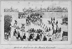
Image 15Drawing of the ruler of Lunda, Mwata Kazembe, receiving Portuguese in the royal courtyard in the 1800s (from History of Zambia)
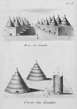
Image 16A drawing of Lunda houses by a Portuguese visitor. The size of the doorways relative to the building emphasizes the scale of the buildings (from Zambia)
Image 18A drawing of Lunda houses by a Portuguese. The size of the doorways relative to the building emphasizes the scale of the buildings. (from History of Zambia)
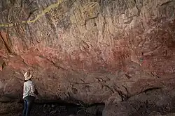
Image 19Ancient (but graffitied) Rock Art in Nsalu Cave, Kasanka National Park in North-Central Zambia (from Zambia)
Image 34Three young Ngoni chiefs. The Ngoni made their way into Eastern Zambia from KwaZulu in South Africa. They eventually assimilated into the local ethnic groups. (from Zambia)
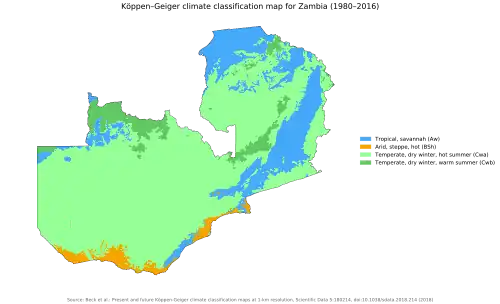
Image 35Zambia map of Köppen climate classification (from Zambia)
Image 36Inside the palace of the Litunga, ruler of the Lozi. Due to the flooding on the Zambezi, the Litunga has two palaces one of which is on higher ground. The movement of Litunga to higher land is celebrated at the Kuomboka Ceremony (from History of Zambia)
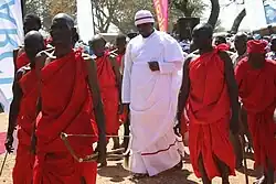
Image 39The Kalonga of the Chewa today descends from the Kalonga (rulers) of the Maravi Empire. (from History of Zambia)
Image 40Ancient (but graffitied) Rock Art in Nsalu Cave, Kasanka National Park in North-Central Zambia. (from History of Zambia)
Image 41Drawing of the ruler of Lunda, Mwata Kazembe, receiving Portuguese in the royal courtyard in the 1800s (from Zambia)
Image 42Inside the palace of the Litunga, ruler of the Lozi. Due to the flooding on the Zambezi, the Litunga has two palaces one of which is on higher ground. The movement of Litunga to higher land is celebrated at the Kuomboka Ceremony (from Zambia)
Image 45An 1864 photograph of the Scottish explorer and missionary David Livingstone (from Zambia)
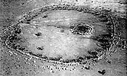
Image 46Enormous Ba-Ila settlement. These communities have been of interest to mathematicians due to their fractal pattern design. (from History of Zambia)
Image 47Tribal and linguistic map of Zambia (from Zambia)
Image 54Three young Ngoni chiefs. The Ngoni made their way into Eastern Zambia from KwaZulu in South Africa. They eventually assimilated into the local ethnic groups. (from Zambia)
Image 63A drawing of Lunda houses by a Portuguese visitor. The size of the doorways relative to the building emphasizes the scale of the buildings (from Zambia)
Image 64Zambia National Assembly building in Lusaka (from Zambia)
Image 65Zambia map of Köppen climate classification (from Zambia)
Image 66The kalonga (ruler) of the Chewa today descends from the kalonga of the Maravi Empire (from Zambia)
Image 67Ila Headman's son in Southern Zambia, Cattle formed an important part of their society. (from History of Zambia)
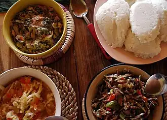
Image 70Nsima (top right corner) with three types of relish. (from Zambia)
Good article -
This is a Good article, an article that meets a core set of high editorial standards.
Zambia competed at the 2012 Summer Olympics in London, held from 27 July to 12 August 2012. The country's participation at London marked its twelfth appearance in the Summer Olympics since its début at the 1964 Summer Olympics. The delegation consisted of seven competitors; three track and field athletes Gerald Phiri, Prince Mumba and Chauzje Choosha, one each in Boxing and Judo (Gilbert Choombe and Boas Munyonga) and two swimmers, Zane Jordan and Jade Ashleigh Howard. Phiri, Mumba, Choombe and Munyonga had qualified by meeting the standards in their respective sports, and Choosha, Jordan and Howard qualified by wildcard places. Mumba was the national flag bearer at the opening and closing ceremonies.
Phiri received a bye in the men's 100 metres and was eliminated at the first round stage and recorded his best time of the 2012 athletic season. Mumba and Choosha were both eliminated from the competition in the parliamentary heats, and Choombe was defeated by AustralianJeff Horn in Boxing's round of 32. Munyonga was disqualified in his round of 32 match against Takahiro Nakai by holding his opponent's leg, a move he later regretted. Jordan failed to advance beyond the heats of the men's 100 metre backstroke despite recording a new personal best, while his female counterpart Howard was also eliminated in the same stage in the women's 100 metre freestyle. (Full article...)

_Luba_peoples_The_Metropolitan_Museum_of_Art.png)

%252C_%25_of_world_average%252C_1960-2012%253B_Zimbabwe%252C_South_Africa%252C_Botswana%252C_Zambia%252C_Mozambique.png)

.jpg)

.jpg)
.svg.png)