Kostohryzove, Kakhovka Raion, Kherson Oblast
Kostohryzove
Костогри́зове | |
|---|---|
Interactive map of Kostohryzove | |
  Kostohryzove Location of Kostohryzove within Ukraine 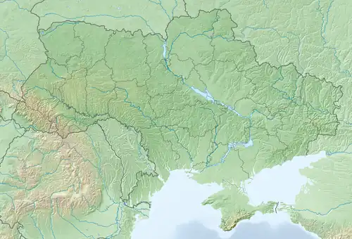 Kostohryzove Kostohryzove (Ukraine) | |
| Coordinates: 46°33′44″N 33°35′06″E / 46.56222°N 33.58500°E | |
| Country |  Ukraine Ukraine |
| Oblast | Kherson Oblast |
| Raion | Kakhovka Raion |
| Area | |
• Total | 0.01 km2 (0.0039 sq mi) |
| Elevation | 39 m (128 ft) |
| Population | |
• Total | 924 |
| • Density | 92,000/km2 (240,000/sq mi) |
| Time zone | UTC+2 (EET) |
| • Summer (DST) | UTC+3 (EEST) |
| Postal code | 74844 |
| Area code | +380 5536 |
Kostohryzove (Ukrainian: Костогри́зове) is a village in southern Ukraine, located in Kakhovka Raion, Kherson Oblast. It has a population of 924.
History
The village was founded in 1900 by migrants from the village of the nearby village of Kostohryzove, which is located in the Kherson Raion.[1] At the time, the village was part of the lands of Nataliya Stroganova, which is where it got its original official name of Stroganivka from.[1] During the Stolypin reform of agriculture, the former land of Stroganova was purchased by the peasants, who declined to keep the original name.[1] The settlers renamed it to Novo-Kostohryzivka, and the settlement was officially mentioned starting in 1911.[1] From 11 September 1941 to 2 November 1943 the village was occupied by German forces during the Great Patriotic War.[1]
On 12 June 2020, Kostohryzove was assigned to Zelenyi Pid rural hromada.[2] Kostohryzove was occupied by Russian forces during the Russian invasion of Ukraine that began in 2022.[3] On 17 July 2020, as a result of administrative-territorial form and liquidation, the village was incorporated into the Kakhovka Raion.[4]
Demographics
According to the 2001 Ukrainian census, the only official census taken in post-independence Ukraine, the village's population was 924. The linguistic composition of the settlement was as follows:[5]
Monuments
On 21 November 2016, on the Day of Dignity and Freedom, a ceremony was held at Kostohryzove Secondary School where a memorial plaque was dedicated to honor Vitaliy Pavlovych Blahovisnyi, who graduated from the school.[6] Blahovisnyi served as a combat engineer and was killed on 14 November 2015 during a mortar attack near Butivka mine in Donetsk Oblast.[6]
References
- ^ a b c d e "Костогризове. Віртуальний проєкт «Краєзнавство Таврії». Херсонська обласна універсальна наукова бібліотека ім. Олеся Гончара". krai.lib.kherson.ua. Retrieved 13 November 2025.
- ^ "Про визначення адміністративних центрів та затвердження територій територіальних громад Херсонської області". Офіційний вебпортал парламенту України (in Ukrainian). Retrieved 2022-10-07.
- ^ "Військовий експерт пояснив, чому російські війська так швидко захопили Херсонську область". www.unian.ua (in Ukrainian). Retrieved 2023-02-27.
- ^ "Про утворення та ліквідацію районів". Офіційний вебпортал парламенту України (in Ukrainian). Retrieved 13 November 2025.
- ^ "Рідні мови в об'єднаних територіальних громадах України". socialdata.org.ua.
- ^ a b "В Костогризівці відкрили меморіальну дошку захиснику України (відео)". Таврийские вести (in Russian). 23 November 2016. Archived from the original on 2016-12-20. Retrieved 13 November 2025.