King Peak (Yukon)
| King Peak | |
|---|---|
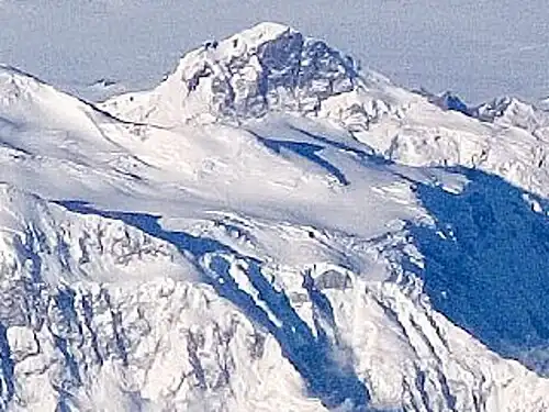 Aerial view (2006) | |
| Highest point | |
| Elevation | 5,173 m (16,972 ft)[1] |
| Prominence | 1,073 m (3,520 ft)[2] |
| Listing | |
| Coordinates | 60°34′59″N 140°39′14″W / 60.58306°N 140.65389°W[1] |
| Geography | |
  King Peak Location in Yukon | |
| Location | Yukon, Canada |
| Parent range | Saint Elias Mountains |
| Topo map | NTS 115C10 King Peak |
| Climbing | |
| First ascent | 6 June 1952 by Keith Hart and Elton Thayer |
| Easiest route | glacier/snow/ice climb |
King Peak (sometimes rendered as Mount King) is a mountain in the Saint Elias Mountains of southwestern Yukon, Canada. At 5,173 m (16,972 ft), it is commonly listed as the fourth-highest mountain in Canada and the ninth-highest peak in North America.[1][2]
Geography
King Peak lies just west of Mount Logan, within the St. Elias range, and is mapped on NTS sheet 115C/10.[1]
Climbing history
The first ascent was completed on 6 June 1952 during a University of Alaska student expedition. Russell Alston Paige, Keith Hart and Elton Thayer reached the summit by traversing the north face from King Col to gain the west ridge; Hart and Thayer are typically listed as the summit pair.[3][4]
The second ascent was made on 23 July 1952 by Gibson Reynolds and Pete Schoening, and the third ascent followed on 24 July 1952 by Dick McGowan and Bill Niendorff, as recorded in contemporary alpine reporting.[5][4]
See also
References
- ^ a b c d "King Peak (place name record)". Canadian Geographical Names Database (Natural Resources Canada). Retrieved 29 December 2025.
- ^ a b "King Peak". Bivouac Mountain Encyclopedia. Retrieved 29 December 2025.
- ^ "North America, Canada, Yukon Territory, King Peak, Correction". American Alpine Journal. Retrieved 29 December 2025.
- ^ a b Scott, Chic (2000). Pushing the Limits: The Story of Canadian Mountaineering. Calgary, Alberta: Rocky Mountain Books. pp. 141–143. ISBN 0-921102-59-3.
- ^ "Yukon Territory, St. Elias Range" (PDF). Alpine Club of Canada Annual. 1953. Retrieved 29 December 2025.
External links
- "King Peak (Bivouac Mountain Encyclopedia)". Bivouac.com. Retrieved 29 December 2025.
- Photo of King Peak (archived)

.svg.png)