Ferreira do Zêzere
Ferreira do Zêzere | |
|---|---|
 View of Ferreira do Zêzere | |
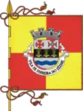 Flag 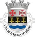 Coat of arms | |
Interactive map of Ferreira do Zêzere | |
  Ferreira do Zêzere Location in Portugal | |
| Coordinates: 39°41′N 8°17′W / 39.683°N 8.283°W | |
| Country | .svg.png) Portugal Portugal |
| Region | Oeste e Vale do Tejo |
| Intermunic. comm. | Médio Tejo |
| District | Santarém |
| Parishes | 7 |
| Government | |
| • President | Bruno Gomes (PS) |
| Area | |
• Total | 190.38 km2 (73.51 sq mi) |
| Population (2011) | |
• Total | 8,619 |
| • Density | 45.27/km2 (117.3/sq mi) |
| Time zone | UTC+00:00 (WET) |
| • Summer (DST) | UTC+01:00 (WEST) |
| Local holiday | Saint Anthony June 13 |
| Website | www |
Ferreira do Zêzere (pronounced [fɨˈʁɐjɾɐ ðu ˈzezɨɾɨ] ⓘ, locally [fɨˈreɾɐ -]) is a portuguese municipality in the historical Ribatejo portuguese province and in Santarém District. The population in 2011 was 8,619,[1] in an area of 190.38 km2.[2] The municipal holiday is June 13.
Parishes
Administratively, the municipality is divided into 7 civil parishes (freguesias):[3]
- Águas Belas
- Areias e Pias
- Beco
- Chãos
- Ferreira do Zêzere
- Igreja Nova do Sobral
- Nossa Senhora do Pranto
History
Ferreira do Zêzere, founded by Pedro Ferreira and his wife in the 13th century, is said to be one of the most-visited villages in the district of Santarém. In the surroundings of the village there is the medieval Vila de Dornes with a view over the Zêzere River and classed as a Templar tower.
References
- ^ Instituto Nacional de Estatística
- ^ "Áreas das freguesias, concelhos, distritos e país". Archived from the original on 2018-11-05. Retrieved 2018-11-05.
- ^ Diário da República. "Law nr. 11-A/2013, page 552 49" (pdf) (in Portuguese). Retrieved 22 July 2014.
External links