Cerro Arequita
| Cerro Arequita | |
|---|---|
.JPG) Cerro Arequita ca. 2011. | |
| Highest point | |
| Elevation | 305 m (1,001 ft) |
| Coordinates | 34°17′27″S 55°16′01″W / 34.29083°S 55.26694°W |
| Naming | |
| English translation | Cerro (Hill in Spanish); Arequita (Water falling from the high rock over the caves in Guaraní) |
| Language of name | Spanish/Guaraní |
| Geography | |
  Cerro Arequita Uruguay | |
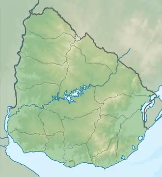
| Location | 10 km north of Minas, Lavalleja Department, Uruguay |
| Parent range | Cuchilla Grande |
| Geology | |
| Mountain type | Hill |
| Climbing | |
| Easiest route | Hike |
.png)
Cerro Arequita is a hill located in Lavalleja Department, Uruguay.
Overview
Its name is of Guarani origin, meaning "water falling from the high rock over the caves".[1]
Since 2024 it is part of the National Park of Arequita, a nature sanctuary full of native species: armadillos, skunks, foxes, Geoffroy's cats, gray brockets, capybaras, river otters, nutrias, bats, chingolos, chalk-browed mockingbirds, dusky-legged guans, turkey vultures, savannah vultures.[2]
An endemic epiphyte flowering plant species is Tillandsia arequitae.[3]
In art
- Carlos Federico Sáez painted this hill in 1899.
- The Cerro Arequita is featured on both the coat of arms and the flag of Lavalleja Department.
Bibliography
- Araújo, Orestes (2012). Diccionario geográfico del Uruguay (in Spanish). Montevideo.
{{cite book}}: CS1 maint: location missing publisher (link)
References
- ^ Sequeira, Alejandro; Casaubou, Cristina; Olveira, Armando (July 2010). "Arequita" (PDF). Áreas protegidas del Uruguay (in Spanish). 2. Retrieved 15 February 2014.
- ^ "Áreas protegidas del Uruguay - Parque Arequita" (PDF). El País (in Spanish). 2 July 2010. Retrieved 16 October 2019.
- ^ "Tillandsia arequitae". Royal Botanic Gardens, Kew: World Checklist of Selected Plant Families. Retrieved 25 August 2025.
External links

Wikimedia Commons has media related to Cerro Arequita.
Capital: Minas | ||
| Towns and villages |  | |
| Sights | ||
