Carrick, New South Wales
Carrick | |||||||||||||
|---|---|---|---|---|---|---|---|---|---|---|---|---|---|
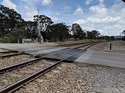 Level crossing on Main Southern Line | |||||||||||||
  Carrick Location in New South Wales | |||||||||||||
| Coordinates: 34°41′57″S 149°53′02″E / 34.69917°S 149.88389°E | |||||||||||||
| Country | Australia | ||||||||||||
| State | New South Wales | ||||||||||||
| Region | Southern Tablelands | ||||||||||||
| LGA | |||||||||||||
| Location | |||||||||||||
| Government | |||||||||||||
| • State electorate | |||||||||||||
| • Federal division | |||||||||||||
| Elevation | 668 m (2,192 ft) | ||||||||||||
| Population | |||||||||||||
| • Total | 164 (SAL 2021)[2] | ||||||||||||
| Postcode | 2580 | ||||||||||||
| County | Argyle | ||||||||||||
| Parish | Nattery | ||||||||||||
| |||||||||||||
Carrick is a locality in the Goulburn Mulwaree Council, New South Wales, Australia.[3] It is located on the northern side of the Hume Highway to the east of Goulburn. At the 2016 census, it had a population of 136.[4] Carrick railway station was a station on the Main Southern railway line from 1869 to 1975.[5] It had a public school from 1873 to 1909, operating as a "half-time" school from 1887.[6]
References
- ^ Australian Bureau of Statistics (28 June 2022). "Carrick (NSW) (suburb and locality)". Australian Census 2021 QuickStats. Retrieved 28 June 2022.
- ^ Australian Bureau of Statistics (28 June 2022). "Carrick (NSW) (suburb and locality)". Australian Census 2021 QuickStats. Retrieved 28 June 2022.
- ^ "Carrick". Geographical Names Register (GNR) of NSW. Geographical Names Board of New South Wales. Retrieved 1 August 2017.
- ^ Australian Bureau of Statistics (27 June 2017). "Carrick (NSW)". 2016 Census QuickStats. Retrieved 1 August 2017.
- ^ "Carrick station". NSWrail.net. Retrieved 28 December 2017.
- ^ "Carrick Public School in the School history database search". New South Wales Department of Education. Retrieved 28 December 2017.
| Towns | |
|---|---|
| Localities and rural places | |
Main Article: Local government areas of New South Wales | |
