Bundesstraße 440
 | |
|---|---|
| Bundesstraße 440 | |
 | |
| Route information | |
| Length | 40 km (25 mi) |
| Major junctions | |
| From | Rotenburg an der Wümme |
| To | Bad Fallingbostel |
| Location | |
| Country | Germany |
| States | Lower Saxony |
| Highway system | |
| |
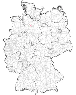
The B 440 is a German federal road in Lower Saxony. It runs from the district town of Rotenburg an der Wümme[1] to Bad Fallingbostel. It was based on an old Army road built by Napoléon Bonaparte.
Course
It begins at the B 215, runs through the so-called Mill Quarter (Mühlenviertel) of Rotenburg an der Wümme, passes nearby Bothel and after about 20 km passes through the town centre of Visselhövede to the southeast. Continuing in a southwesterly direction it crosses the Bomlitz valley north of Bomlitz. In Dorfmark (part of Bad Fallingbostel) it crosses the B 209 and joins the A 7 motorway just east of the village.
_mit_Kreis%252C_StVO_1992.svg.png) |
Rotenburg (Wümme)  B 215 B 215
| |
|
Hassel | |
|
Wittorf | |
|
Visselhövede L171 | |
|
Ottingen | |
|
Bommelsen | |
|
Dorfmark  A 7 A 7
|
See also
References
- ^ "Bundesstraßenverzeichnis, Ausgabe 2009 (BVERZ 2009)" (PDF). Bundesanstalt für Straßenwesen (in German). Federal Ministry for Digital and Transport. 30 October 2009. p. 371. Retrieved 28 November 2024.