Berino, New Mexico
Berino, New Mexico | |
|---|---|
  Berino | |
| Coordinates: 32°04′15″N 106°37′17″W / 32.07083°N 106.62139°W | |
| Country | United States |
| State | New Mexico |
| County | Doña Ana |
| Area | |
• Total | 0.94 sq mi (2.43 km2) |
| • Land | 0.94 sq mi (2.43 km2) |
| • Water | 0 sq mi (0.00 km2) |
| Elevation | 3,832 ft (1,168 m) |
| Population | |
• Total | 1,651 |
| • Density | 1,756.9/sq mi (678.33/km2) |
| Time zone | UTC-7 (Mountain (MST)) |
| • Summer (DST) | UTC-6 (MDT) |
| Area code | 575 |
| GNIS feature ID | 920560[3] |
Berino is a census-designated place in Doña Ana County, New Mexico, United States. Berino is located along Interstate 10, 23 miles (37 km) south of Las Cruces. As of the 2010 census, its population was 1,441. The village of Berino is populated to 98% by Hispanics.[4]
The church of the small New Mexican community is called the Mission de la Inmaculada Concepción.
In early April 1932, a local rancher Melquiades (sic) Espinosa was arrested after the bodies of his wife and six children were found murdered. [5]
Demographics
| Census | Pop. | Note | %± |
|---|---|---|---|
| 2020 | 1,651 | — | |
| U.S. Decennial Census[6][2] | |||
References
- ^ "ArcGIS REST Services Directory". United States Census Bureau. Retrieved October 12, 2022.
- ^ a b "Census Population API". United States Census Bureau. Retrieved October 12, 2022.
- ^ "Berino". Geographic Names Information System. United States Geological Survey, United States Department of the Interior.
- ^ "U.S. Census website". United States Census Bureau. Retrieved May 14, 2011.
- ^ "Charged with 7 Murders" (PDF). New York Times. AP. April 25, 1932. Retrieved December 26, 2025.
- ^ "Census of Population and Housing". Census.gov. Retrieved June 4, 2016.
Municipalities and communities of Doña Ana County, New Mexico, United States | ||
|---|---|---|
| Cities | 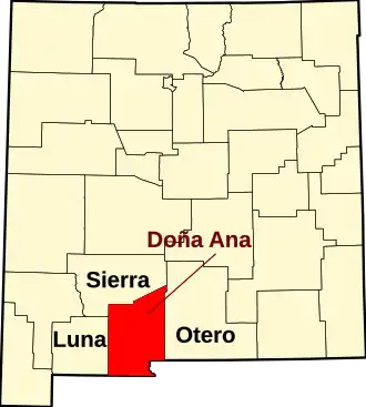 | |
| Town | ||
| Village | ||
| CDPs | ||
| Ghost towns | ||
| ||